| 
|
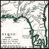
1718,
Carte de la Louisiane et du cours du Mississipi [i.e. Mississippi]:
dressée sur un grand nombre de mémoires entrautres sur
ceux de Mr. le Maire / par Guillaume Del'isle del Academie R'le. des
Sciences. |
| 
|
1718,
Carte de la Louisiane et du cours du Mississipi [i.e. Mississippi]:
dressée sur un grand nombre de mémoires entrautres sur
ceux de Mr. le Maire / par Guillaume Del'isle del Academie R'le. des
Sciences. |
| 
|
1718,
Carte de la Louisiane et du cours du Mississipi [i.e. Mississippi]:
dressée sur un grand nombre de mémoires entrautres sur
ceux de Mr. le Maire / par Guillaume Del'isle del Academie R'le. des
Sciences. |
| 
|
1718,
Carte de la Louisiane et du cours du Mississipi [i.e. Mississippi]:
dressée sur un grand nombre de mémoires entrautres sur
ceux de Mr. le Maire / par Guillaume Del'isle del Academie R'le. des
Sciences. |
| 
|
1718,
Carte de la Louisiane et du cours du Mississipi [i.e. Mississippi]:
dressée sur un grand nombre de mémoires entrautres sur
ceux de Mr. le Maire / par Guillaume Del'isle del Academie R'le. des
Sciences. |
| 
|
1719,
A new & correct map of the whole World. |
| 
|
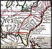
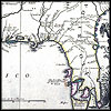
1720,
A new map of the north parts of America claimed by France under ye names
of Louisiana, Mississipi [i.e. Mississippi], Canada, and New France
with ye adjoining territories of England and Spain : to Thomas Bromsall,
esq., this map of Louisiana, Mississipi [i.e. Mississippi] & c.
is most humbly dedicated, H. Moll, geographer / laid down according
to the newest and most exact observations by H. Moll, geographer. |
| 
|
1720,
A new map of the north parts of America claimed by France under ye names
of Louisiana, Mississipi [i.e. Mississippi], Canada, and New France
with ye adjoining territories of England and Spain : to Thomas Bromsall,
esq., this map of Louisiana, Mississipi [i.e. Mississippi] & c.
is most humbly dedicated, H. Moll, geographer / laid down according
to the newest and most exact observations by H. Moll, geographer. |
| 
|
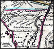
1720,
A new map of the north parts of America claimed by France under ye names
of Louisiana, Mississipi [i.e. Mississippi], Canada, and New France
with ye adjoining territories of England and Spain : to Thomas Bromsall,
esq., this map of Louisiana, Mississipi [i.e. Mississippi] & c.
is most humbly dedicated, H. Moll, geographer / laid down according
to the newest and most exact observations by H. Moll, geographer. |
| 
|
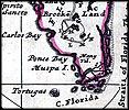
1720,
A new map of the north parts of America claimed by France under ye names
of Louisiana, Mississipi [i.e. Mississippi], Canada, and New France
with ye adjoining territories of England and Spain : to Thomas Bromsall,
esq., this map of Louisiana, Mississipi [i.e. Mississippi] & c.
is most humbly dedicated, H. Moll, geographer / laid down according
to the newest and most exact observations by H. Moll, geographer. |
| 
|
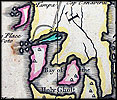
1721,
A map of Louisiana and of the river Mississipi [i.e. Mississippi] :
this map of the Mississipi [i.e. Mississippi] is most humbly inscribed
to William Law of Lanreston, esq. / by Iohn Senex. |
| 
|
1721,
A map of Louisiana and of the river Mississipi [i.e. Mississippi] :
this map of the Mississipi [i.e. Mississippi] is most humbly inscribed
to William Law of Lanreston, esq. / by Iohn Senex. |
| 
|
1721,
A map of Louisiana and of the river Mississipi [i.e. Mississippi] :
this map of the Mississipi [i.e. Mississippi] is most humbly inscribed
to William Law of Lanreston, esq. / by Iohn Senex. |
| 
|
1721,
A map of Louisiana and of the river Mississipi [i.e. Mississippi] :
this map of the Mississipi [i.e. Mississippi] is most humbly inscribed
to William Law of Lanreston, esq. / by Iohn Senex. |
| 
|
1732,
Carte de la côte de la Louisiane depuis la Baye St. Joseph, jusqu'à
celle de St. Bernard où tous les ports et bons mouillages sont
marquez par des ancres; avec la quantité de piés d'eau
que l'on y trouve. |
| 
|
1732,
Carte de la côte de la Louisiane depuis la Baye St. Joseph, jusqu'à
celle de St. Bernard où tous les ports et bons mouillages sont
marquez par des ancres; avec la quantité de piés d'eau
que l'on y trouve. |
| 
|
Map
of Fort Matanzas shoreline circa 1742. |
| 
|
1744,
Carte de la Louisiane cours du Mississipi [i.e. Mississippi] et pais
voisins : dediée à M. le Comte de Maurepas, ministre et
secretaire d'etat commandeur des ordres du roy / par N. Bellin ingenieur
de la marine, 1744 ; Dheulland sculp. |
| 
|
1744,
Carte de la Louisiane cours du Mississipi [i.e. Mississippi] et pais
voisins : dediée à M. le Comte de Maurepas, ministre et
secretaire d'etat commandeur des ordres du roy / par N. Bellin ingenieur
de la marine, 1744 ; Dheulland sculp. |
| 
|
1744,
Carte de la Louisiane cours du Mississipi [i.e. Mississippi] et pais
voisins : dediée à M. le Comte de Maurepas, ministre et
secretaire d'etat commandeur des ordres du roy / par N. Bellin ingenieur
de la marine, 1744 ; Dheulland sculp. |
| 
|
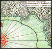
1744,
Carte de la Louisiane cours du Mississipi [i.e. Mississippi] et pais
voisins : dediée à M. le Comte de Maurepas, ministre et
secretaire d'etat commandeur des ordres du roy / par N. Bellin ingenieur
de la marine, 1744 ; Dheulland sculp. |
| 
|
1747,
Carte general de toute la côte de la Louisianne jusqu'a la Baye
St. Bernard, coste de la Floride, Baye de la Mobille, Be. de Pansacole,
Baye de St. Ioseph, St. Marc des Apalaches. dans l'Amerique septentle.,
1747 / A. Debatz, fecit. |
| 
|
1747,
Carte general de toute la côte de la Louisianne jusqu'a la Baye
St. Bernard, coste de la Floride, Baye de la Mobille, Be. de Pansacole,
Baye de St. Ioseph, St. Marc des Apalaches. dans l'Amerique septentle.,
1747 / A. Debatz, fecit. |
| 
|
1747,
Carte general de toute la côte de la Louisianne jusqu'a la Baye
St. Bernard, coste de la Floride, Baye de la Mobille, Be. de Pansacole,
Baye de St. Ioseph, St. Marc des Apalaches. dans l'Amerique septentle.,
1747 / A. Debatz, fecit. |
 |
Map
of Florida and Cuba from 1757. |
 |
Detailed
view of northern Florida from 1757. |
 |
Detailed
view of southern Florida from 1757. |
 |
A
survey map of Florida, 1769.  |
 |
A
map of the route from St. Augustine to St. Mark of Apalache on a map from
1769. |
 |
A
map of the Florida Keys, 1769. |
 |
Map
of Florida and the Gulf of Mexico, 1775.  |
 |
Detail
of East and West Florida, 1775. |
 |
The
Bay of Espiritu Santo on the western coast of East Florida, 1777. 
|
 |
Map
of East and West Florida from 1781. |
 |
Detailed
view of Tampa Bay from 1781. |
 |
Detailed
view of Charlotte Harbor from 1781. |
 |
Detailed
view of the southwest coast of Florida from 1781. |
 |
Detailed
view of the Florida Keys from 1781. |
 |
Detailed
view of Key Largo from 1781. |
 |
Detailed
view of the southeast coast of Florida from 1781. |
 |
A
map showing East and West Florida from 1781. |
 |
Detailed
view of Pensacola Bay from 1781. |
 |
Detailed
view of Santa Rosa Bay from 1781. |
 |
Detailed
view of St. Andrew's Bay from 1781. |
 |
Detailed
view of Pensacola Bay from 1781. |
 |
Detailed
view of the Cabbage Tree Coast from 1781. |
 |
Detailed
view of Spruce Creek from 1781. |
 |
Map
of the Bay of Pensacola from 1782. |
 |
Detailed
view of Santa Rosa Island from 1782. |
| 
|
A
map of Florida and Cuba from 1783. |
 |
Map
of the coast of Florida from 1784. |
 |
Detailed
view of the northeast portion of Florida from 1784. |
 |
Detailed
view of where the Mississippi River enters the state from 1784. |
| 
|
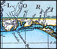
1796,
A general chart of the West Indies. |
| 
|
1796,
A general chart of the West Indies. |
| 
|
1796,
A general chart of the West Indies. |
| 
|
1796,
A general chart of the West Indies. |
| 
|
1796,
A general chart of the West Indies. |
| 
|
1796,
A general chart of the West Indies. |