| Home > Maps > Leon City and Local Maps > Aerial View of Tallahassee, 1926 > Florida State Capitol | |
|
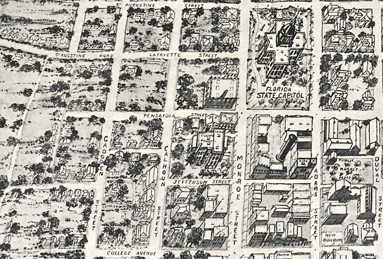
Florida State Capitol. Area bounded by St. Augustine Street, Duval Street, and College Avenue. Also includes the public market, Lafayette Street, Adams Street, Gadsden Street, Calhoun Street, Monroe Street, and Pensacola Street.
|
|
Map Credit: Courtesy of the Library of Congress.
|
| Home > Maps > Leon City and Local Maps > Aerial View of Tallahassee, 1926 > Florida State Capitol |
Exploring
Florida: A Social Studies Resource for Students and Teachers
Produced by the Florida Center for Instructional
Technology,
College of Education, University of South Florida ©2004.