 |
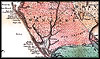
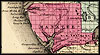
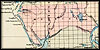
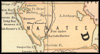
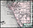
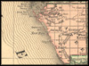
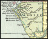
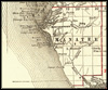
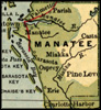
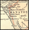
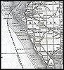
Detailed
view of Manatee County from 1856. |
 |
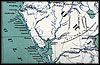
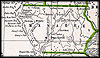
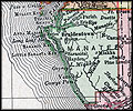
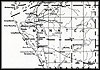
1859,
Surveyor General map. |
 |
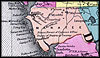
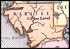
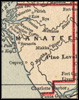
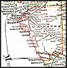
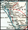
1860,
"Detailed map showing drainage, state and county boundaries, place
names, steamboat routes, and railroad network." |
| 1863, Johnson & Ward map. |
| 1863, Map of Florida that was, "Entered according to Act of Congress in the year 1863 by A. J. Johnson in the clerks office of the District Court of the United States for the Southern District of New York." |
| 1865, General Topographical Map Sheet XI, Atlas to Accompany the Official Records of the Union and Confederate Armies. |
| 1873, Map of Florida. |
| 1874, Drew's New Map of the State of Florida, published by Columbus Drew, Jacksonville. |
| 1877, Map of Florida that was, "Entered according to Act of Congress in the year 1877 by Asher and Adams...." |
| 1880, Map of Florida. |
| 1880, Rand, McNally & Company map. |
 |
1882,
Colton & Company map. |
|
|
1883,
Phillips and Hunt map. |
| 1886, Geo.F.Cram Engraver & Publisher map. |
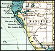
| 1888, A new sectional map of Florida issued by the land department of the South Florida R.R. Co. and the Plant Investment Co., Sanford, Florida. |
| 1888, "New sectional map of the eastern and southeastern portion of the state of Florida. Issued by the land department of the Florida Southern Railway Company. Showing the lands, owned and offered for sale by said department." |
| 1888, Rand, McNally & Company map. |
| 1890, George F. Cram map. |
| 1890, Rand, McNally & Company map. |
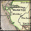
| 1890s, Map of Florida created during the 1890s that also indicates train routes of various rail companies. |
|
|
1892,
Rand, McNally & Company map. |
 |
1893,
George F. Cram map. |
| 1894, Rand, McNally & Company map. |
| 1897, The Century Atlas. |
 |
1898,
John W. Iliff and Company map. |
| 1898, Rand, McNally & Co.'s New Business Atlas Map of Florida. |
| 1899, Published by George F. Cram, Chicago. |
 |
1900,
Mast, Crowell & Kirkpatrick map. |
 |
1900,
Rand, McNally & Company map. |
| 1900, Unrivaled Atlas of the World, published by Philadephia Public Ledger. |
| 1902, George F. Cram map. |
 |
1904,
Tunison's map. |
 |
1907,
Dodd, Meed and Company map. |
| 1910, Hammond map. |
| 1910, Rand-McNally. |
| 1911, Rand, McNally & Company map. |
 |
1914,
Collier map. |
| 1916, National Map Company map. |
| 1916, The New Reference Atlas of the World, published by C. S. Hammond & Company. |
| 1917, Rand, McNally & Company map. |
| 1920, US Railroad Administration map. |
| 1921, L.L. Poates Co. map. |
| 1932, United States Geological Survey. |