| Home > Maps > Okeechobee County | |
Click on a thumbnail image to view a full size version of that map.
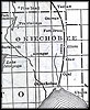
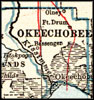
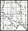
Okeechobee County is Florida's 54th county, established on May 8, 1917, from segments of Osceola County and Brevard County. It gains its name from the Hitchiti Indian words for "big water" (oki meaning water and chobi meaning big). Okeechobee, originally called Tantie after Tantie Huckabee, a Carolina schoolteacher who moved to this area and promoted learning, is the county seat.
For earlier maps of this area, visit the Osceola County and Brevard County map galleries.
| Home > Maps > Okeechobee County |
Exploring
Florida: A Social Studies Resource for Students and Teachers
Produced by the Florida Center for Instructional
Technology,
College of Education, University of South Florida © 2004.