| Home > Maps > Palm Beach County | |
Click on a thumbnail image to view a full size version of that map.
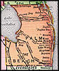
Palm Beach County is Florida's 47th county, established on April 30, 1909, from a segment of Dade County. It gains its name from the large amounts of coconut palm trees found on Atlantic coast of Florida. West Palm Beach is the county seat.
For earlier maps of this area, visit the Dade County map gallery.
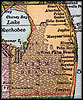
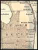
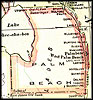
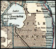
1914, Collier map.
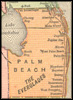
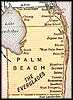
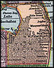
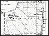
1916, The New Reference Atlas of the World, published by C. S. Hammond & Company.
| Home > Maps > Palm Beach County |
Exploring
Florida: A Social Studies Resource for Students and Teachers
Produced by the Florida Center for Instructional
Technology,
College of Education, University of South Florida © 2004.