|
|
|
| FL Maps > Local > Gulf |
Click on a thumbnail image to view a full size version of that map.
|
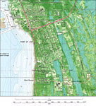
Port St. Joe Detail,
1982 |
|
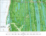
St. Josephs Bay Country Club,
1982 |
|
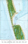
Eagle Harbor,
1982 |
|
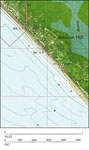
Beacon Hill Detail,
1982 |
| First | Previous |
| FL Maps > Local > Gulf |
Maps ETC
is a part of the
Educational Technology Clearinghouse
Produced by the
Florida Center for Instructional Technology
© 2007
College of Education
,
University of South Florida