Maps Site map
  FL Maps > County Maps with Unlabeled Waterways
Site Map  

  Record   51   to   66  of   66

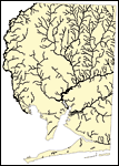
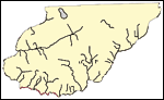
Florida Waterways: Pasco County Outline without Labels, 2008
This topographical map was created by FCIT and shows the waterways of Pasco County. All major rivers, streams, creeks, canals, bays and lakes are present, but not labeled. For a student activity sheet with directions for labeling the following: Pithl...

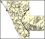
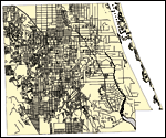
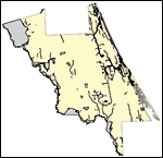
Florida Waterways: Pinellas County Outline without Labels, 2008
This topographical map was created by FCIT and shows the waterways of Pinellas County. All major rivers, streams, creeks, canals, bays and lakes are present, but not labeled. For a student activity sheet with directions for labeling the following: La...

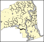
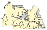
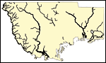
Florida Waterways: Polk County Outline without Labels, 2008
This topographical map was created by FCIT and shows the waterways of Polk County. All major rivers, streams, creeks, canals, bays and lakes are present, but not labeled. For a student activity sheet with directions for labeling the following: Withla...

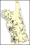
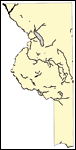
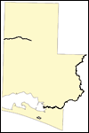
Florida Waterways: Putnam County Outline without Labels, 2008
This topographical map was created by FCIT and shows the waterways of Putnam County. All major rivers, streams, creeks, canals, bays and lakes are present, but not labeled. For a student activity sheet with directions for labeling the following: St. ...

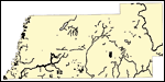
Florida Waterways: Santa Rosa County Outline without Labels, 2008
This topographical map was created by FCIT and shows the waterways of Santa Rosa County. All major rivers, streams, creeks, canals, bays and lakes are present, but not labeled. For a student activity sheet with directions for labeling the following: ...

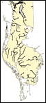
Florida Waterways: Sarasota County Outline without Labels, 2008
This topographical map was created by FCIT and shows the waterways of Sarasota County. All major rivers, streams, creeks, canals, bays and lakes are present, but not labeled. For a student activity sheet with directions for labeling the following: My...

Florida Waterways: Seminole County Outline without Labels, 2008
This topographical map was created by FCIT and shows the waterways of Seminole County. All major rivers, streams, creeks, canals, bays and lakes are present, but not labeled. For a student activity sheet with directions for labeling the following: La...

Florida Waterways: St Johns County Outline without Labels, 2008
This topographical map was created by FCIT and shows the waterways of Saint Johns County. All major rivers, streams, creeks, canals, bays and lakes are present, but not labeled. For a student activity sheet with directions for labeling the following:...

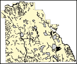
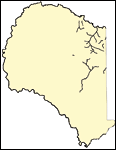
Florida Waterways: St Lucie County Outline without Labels, 2008
This topographical map was created by FCIT and shows the waterways of Saint Lucie County. All major rivers, streams, creeks, canals, bays and lakes are present, but not labeled. For a student activity sheet with directions for labeling the following:...

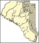
Florida Waterways: Sumter County Outline without Labels, 2008
This topographical map was created by FCIT and shows the waterways of Sumter County. All major rivers, streams, creeks, canals, bays and lakes are present, but not labeled. For a student activity sheet with directions for labeling the following: John...

Florida Waterways: Suwannee County Outline without Labels, 2008
This topographical map was created by FCIT and shows the waterways of Suwannee County. All major rivers, streams, creeks, canals, bays and lakes are present, but not labeled. For a student activity sheet with directions for labeling the following: Su...

Florida Waterways: Taylor County Outline without Labels, 2008
This topographical map was created by FCIT and shows the waterways of Taylor County. All major rivers, streams, creeks, canals, bays and lakes are present, but not labeled. For a student activity sheet with directions for labeling the following: Fenh...

Florida Waterways: Union County Outline without Labels, 2008
This topographical map was created by FCIT and shows the waterways of Union County. All major rivers, streams, creeks, canals, bays and lakes are present, but not labeled. For a student activity sheet with directions for labeling the following: Pales...

Florida Waterways: Volusia County Outline without Labels, 2008
This topographical map was created by FCIT and shows the waterways of Volusia County. All major rivers, streams, creeks, canals, bays and lakes are present, but not labeled. For a student activity sheet with directions for labeling the following: Lak...

Florida Waterways: Wakulla County Outline without Labels, 2008
This topographical map was created by FCIT and shows the waterways of Wakulla County. All major rivers, streams, creeks, canals, bays and lakes are present, but not labeled. For a student activity sheet with directions for labeling the following: Wak...

Florida Waterways: Walton County Outline without Labels, 2008
This topographical map was created by FCIT and shows the waterways of Walton County. All major rivers, streams, creeks, canals, bays and lakes are present, but not labeled. For a student activity sheet with directions for labeling the following: Shoa...

First Previous


  FL Maps > County Maps with Unlabeled Waterways
Site Map  

Maps ETC is a part of the Educational Technology Clearinghouse
Produced by the Florida Center for Instructional Technology © 2007
College of Education , University of South Florida