| Home > Maps > Leon City and Local Maps > Aerial View of Tallahassee, 1926 > Tallahassee Detail | |
|
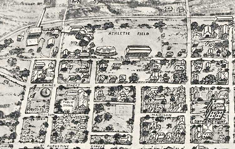
Tallahassee Detail. Area southeast of the Capitol including the Supreme Court, a public school, the atheletic field, Gaines Street, and Madison Street.
|
|
Map Credit: Courtesy of the Library of Congress.
|
| Home > Maps > Leon City and Local Maps > Aerial View of Tallahassee, 1926 > Tallahassee Detail |
Exploring
Florida: A Social Studies Resource for Students and Teachers
Produced by the Florida Center for Instructional
Technology,
College of Education, University of South Florida ©2004.