Bialystok Ghetto Map
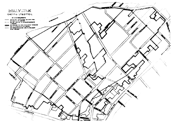
Map of the ghetto in Bialystok, April 2, 1943. Over 50,000 people lived here at the end of 1941. The (eastern) boundary of the ghetto was Sienkiewicz Street, renamed on the map as "Erich Koch Street."
Photo credit: Meczenstwo Walka, Zaglada Aydów w Polsce 1939-1945. Poland. No. 49.
![]()
![]()
A Teacher's Guide to the Holocaust
Produced by the Florida Center for Instructional Technology,
College of Education, University of South Florida © 1997-2013.