| Home
> Maps > 1700s >
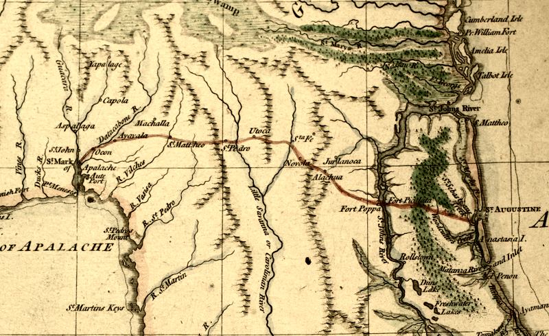
East Florida 1769 |
|

|
From
1769, "East Florida, from surveys made since the last peace adapted
to Dr. Stork's History of that Country, by Thomas Jefferys, geographer
to the King." Detailed view of the route from St. Augustine to St.
Mark of Apalache.
|
Exploring
Florida: A Social Studies Resource for Students and Teachers
Produced by the Florida Center for Instructional
Technology,
College of Education, University of South Florida © 2002.