| Home > Maps > 1800s > East Florida 1806 | |
|
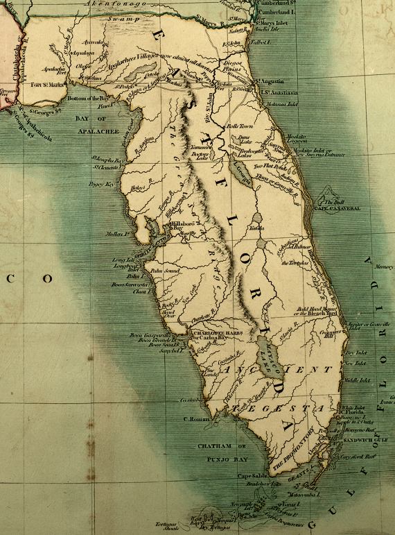
"A
new map of part of the United States of North America containing the Carolinas
and Georgia. Also the Floridas and part of the Bahama Islands from the
latest authorities." This is a detailed view of East Florida from
a map created in 1806.
|
|
Map Credit: Courtesy of the Special Collections Department, University of South Florida. Digitization provided by the USF Libraries Digitization Center.
|
| Home > Maps > 1800s > East Florida 1806 |
Exploring
Florida: A Social Studies Resource for Students and Teachers
Produced by the Florida Center for Instructional
Technology,
College of Education, University of South Florida © 2002.