| Home > Maps > Columbia County > 1859 Map | |
|
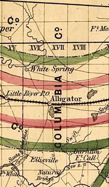
Columbia
County as shown on a 1859 Surveyor General map. This map was created to
accompany the annual report of the Surveyor General. It is a township
map showing drainage, cities and towns, railroads, location of the land
grant railroads and indicates the 6- and 15-mile limits of grants.
|
|
Map Credit: Courtesy of the Library of Congress, Geography and Map Division. |
| Home > Maps > Columbia County > 1859 Map |
Exploring
Florida: A Social Studies Resource for Students and Teachers
Produced by the Florida Center for Instructional
Technology,
College of Education, University of South Florida © 2002.