| Home > Maps > Bay County | |
Click on a thumbnail image to view a full size version of that map.
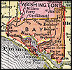
Bay County is Florida's 49th county, established on April 24, 1913, from a segment of Washington County. It gains its name from Saint Andrews Bay, a body of water bordering the county. Panama City is the county seat. Panama was a shipbuilding and industrial center during World War II that was named after Panama City.
For earlier maps of this area, visit the Washington County map gallery.
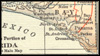
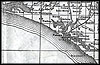
1914, Collier map.
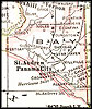
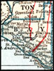
1916, The New Reference Atlas of the World, published by C. S. Hammond & Company.
| Home > Maps > Bay County |
Exploring
Florida: A Social Studies Resource for Students and Teachers
Produced by the Florida Center for Instructional
Technology,
College of Education, University of South Florida © 2004.