| Home > Maps > Broward County | |
Click on a thumbnail image to view a full size version of that map.
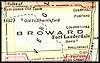
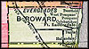
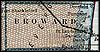
Broward County is Florida's 51st county, established on April 30, 1915, from a segment of Dade County (Miami-Dade). It gains its name from Napoleon B. Broward, the Governor of Florida from 1905-1909. Fort Lauderdale, named after Major William Lauderdale of Tennessee, is the county seat. On March 5, 1838, the battalion he commanded during the Second Seminole War established a post, later given his name, on the New River.
For earlier maps of this area, visit the Dade County (Miami-Dade) map gallery.
| Home > Maps > Broward County |
Exploring
Florida: A Social Studies Resource for Students and Teachers
Produced by the Florida Center for Instructional
Technology,
College of Education, University of South Florida © 2004.