| Home > Maps > Pinellas County | |
Click on a thumbnail image to view a full size version of that map.
Pinellas County is Florida's 48th county, established on May 23, 1911, from a segment of Hillsborough County. It gains its name from a derivative of the Spanish name for the area Punta Pinal meaning "point of pines." Clearwater, originally named Clear Water Harbor because of a spring located near the Gulf coast that made the water clear and sparkling, is the county seat.
For earlier maps of this area, visit the Hillsborough County map gallery.
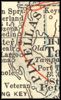
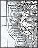
1914, Collier map.
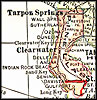
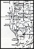
1916, The New Reference Atlas of the World, published by C. S. Hammond & Company.
| Home > Maps > Pinellas County |
Exploring
Florida: A Social Studies Resource for Students and Teachers
Produced by the Florida Center for Instructional
Technology,
College of Education, University of South Florida © 2004.