Maps Site map
  FL Maps > County > Sumter
Site Map  

Sumter County Maps

Click on a thumbnail image to view a full size version of that map.

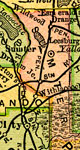
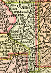
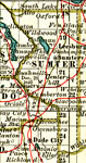
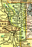
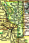
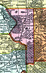
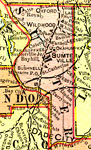
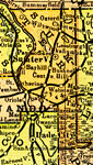
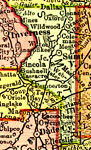
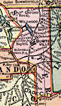
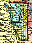
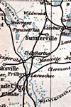
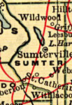
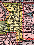
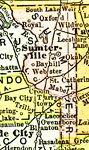
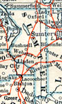
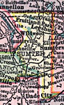
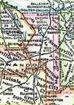
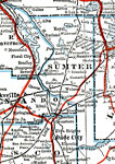
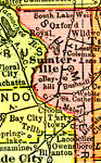
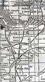
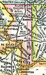
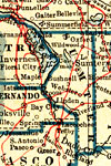
Sumter County is Florida's 29th county, established on January 8, 1853, from a segment of Orange County. It gains its name from Thomas Sumter (1736-1832), a prominent general of southern campaigns during the Revolutionary War. Bushnell is the county seat.

For earlier maps of this area, visit the Orange County map gallery.


  Record   26   to   50  of   86

Sumter County, 1894
A map of Sumter County showing county lines, the county seat (Sumterville), railroads, and cities current to 1894....

Sumter County, 1895
This Florida map of Sumter County outlines the county boundary and railroads connecting the major cities, current to 1895. ...

Sumter County, 1897
A map of Sumter County showing forts, towns, bodies of water, county lines, the county seat (Sumterville), and railroads connecting the major cities current to 1897. Township and Range grids extending from the Tallahassee Meridian and Tallahassee Bas...

Sumter County, 1898
A map of Sumter County as of 1898 showing rivers, railroads, towns, and the county seat, Sumterville....

Sumter County, 1898
A map of Sumter County showing county lines, the county seat (Sumterville), and railroads connecting the major cities current to 1898....

Sumter County, 1898
Digitization provided by the USF Libraries Digitization Center. Rare Maps. This is a detail map of Sumter county circa 1898. This map shows section township range (STR). Main cities and towns are shown such as the county seat Sumterville. Inland wate...

Sumter County, 1899
A map of Sumter County showing county lines, the county seat (Sumterville), and railroads connecting the major cities current to 1899....

Sumter County, 1900
A map of Sumter County showing county lines, the county seat (Sumterville), railroads, and cities current to 1900....

Sumter County, 1900
A map of Sumter County showing county lines, the county seat (Sumterville), railroads, and cities current to 1900....

Florida Railroads - Sumter County, 1900
This detail of Sumter County shows railroads, county boundaries, wetlands, cities, towns, villages, post offices, lakes, and rivers current to 1900. There are 33 railroad lines listed on the main map, as a guide to the numbering. The map was a pocket...

Sumter County, 1902
This is a detail of a map of Florida, displaying county borders, county seats, and railroads current to 1902 for Sumter County. Major and minor cities are shown, as well as major waterways. The features of the map include Sumterville, Wildwood, and O...

Sumter County, 1904
A map of Sumter County showing county lines, the county seat (Sumterville), railroads, and cities current to 1904. ...

Sumter County, 1904
This detail of Sumter County is taken from a handbook for travelers by Karl Baedeker current to 1904. Though made in Leipzig, Germany, the detail was based upon government topographic surveys. It shows footpaths, railways, and roads wherever possible...

Sumter County, 1907
A map of Sumter County showing county lines, the county seat (Sumterville), and railroads connecting the major cities current to 1907....

Sumter County, 1910
This detail of a map of Florida shows county boundaries, roads, cities, towns, villages, lakes, and rivers current to 1910 for Sumter County. On the main map, counties and major cities and towns are listed along the left and bottoms edges with corres...

Sumter County, 1911
A map of Sumter County showing county lines, the county seat (Sumterville), railroads, and cities current to 1911....

Sumter County, 1914
A map of Sumter County showing county lines, the county seat (Sumterville), railroads, and cities current to 1914....

Sumter County, 1916
This detail of a map of Florida shows county boundaries, roads, cities, towns, villages, lakes, and rivers current to 1916 for Sumter County. This detail has counties and major cities and towns listed in larger font. The counties are also colored for...

Sumter County, 1916
This map of Sumter County shows the county seat (Sumterville), county boundaries, wetlands, railroads, and cities current to 1916....

Sumter County, 1917
A map of Sumter County showing county lines, the county seat (Sumterville), railroads, and principal auto routes connecting the major cities current to 1917....

Sumter County, 1917
A map of Sumter County showing county lines, the county seat (Sumterville), railroads, and cities current to 1917....

Sumter County, 1920
This detail of a map of Florida shows railroads and major cities and towns current to 1920 for Sumter County. Major waterways are present, though secondary to the railways functions. Featured cities in this detail include Sumterville, Webster, and Ta...

Sumter County, 1921
A map of Sumter County showing county lines, the county seat (Sumterville), and railroads connecting the major cities current to 1921....

Sumter County, 1921
A map of Sumter County showing county lines, the county seat (Sumterville), railroads, and cities current to 1921....

Sumter County, 1932
This detail of a map of Florida shows railroads and major cities and towns current to 1932 for Sumter County. Major waterways are shown, as well as lakes, town, islands, and marsh. Other notable features are Seminole Indian Reservations, canals, and ...

First Previous Next Last


  FL Maps > County > Sumter
Site Map  

Maps ETC is a part of the Educational Technology Clearinghouse
Produced by the Florida Center for Instructional Technology © 2007
College of Education , University of South Florida