Maps Site map
  FL Maps > Local > Lee
Site Map  

City and Local Maps for Lee County

Click on a thumbnail image to view a full size version of that map.


  Record   1   to   25  of   32

Lee County - East side, 1888
This detail shows county lines and county seats current to the period, major towns and cities, and railroad routes and stations for the east side of Lee County. The Townships are subdivided into sections, and those sections offered for sale by the la...

Lee County - West side, 1888
This detail shows county lines and county seats current to the period, major towns and cities, and railroad routes and stations for the west side of Lee County. The Townships are subdivided into sections, and those sections offered for sale by the la...

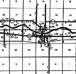
Alva, 1936
This is a detailed map of the city Alva in Lee County, Florida. Section Township Range (STR) is shown. This map shows state roads, railroads, a school, a post office, a hotel, businesses, a church, sawmill, farm units and dwellings other than farms. ...

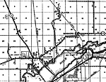
Bayshore, 1936
This is a detailed map of the city Bayshore in Lee County, Florida. Section Township Range (STR) is shown. This map shows state roads, US highway, railroads, businesses, tenant houses, churches, schools, camps, a post office, sawmill, farm units and ...

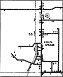
Bonita Springs Insert, 1936
This is a detailed map of the city Bonita Springs in Lee County, Florida. Section Township Range (STR) is shown. This map shows state roads, US highway, railroads, hotels, businesses, churches, a school, a post office, camps, farm units and dwellings...

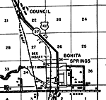
Bonita Springs, 1936
This is a detailed map of the city Bonita Springs in Lee County, Florida. Section Township Range (STR) is shown. This map shows state roads, US highway, railroads, camps, sawmills, a business, farm units and dwellings other than farms.

Buckingham, 1936
This is a detailed map of the city Buckingham in Lee County, Florida. Section Township Range (STR) is shown. This map shows state roads, railroads, businesses, schools, farm units and dwellings other than farms. Key to F...

Estero, 1936
This is a detailed map of the city Estero in Lee County, Florida. Section Township Range (STR) is shown. This map shows state roads, railroads, farm units and dwellings other than farms. Key to Florida Highway maps....

Pineland, 1936
This is a detailed map of the city Pineland in Lee County, Florida. Section Township Range (STR) is shown. This map shows roads, a school, a church, a post office, farm units and dwellings other than farms. Key to Florid...

Salvista, 1936
This is a detailed map of the city Salvista in Lee County, Florida. Section Township Range (STR) is shown. This map shows state roads, railroads, businesses, a school, camps, tenant house, farm units and dwellings other than farms.

Sanibel, 1936
This is a detailed map of the city Sanibel in Lee County, Florida. Section Township Range (STR) is shown. This map shows state roads, post offices, businesses, a hotel, schools, townhall, farm units and dwellings other than farms.

Tice Insert, 1936
This is a detailed map of the city Tice in Lee County, Florida. Section Township Range (STR) is shown. This map shows state roads, railroads, businesses, a school, a post office, farm units and dwellings other than farms. Ke...

Truckland, 1936
This is a detailed map of the city Truckland in Lee County, Florida. Section Township Range (STR) is shown. This map shows state roads, US highway, railroads, tenant houses, businesses, a school, a camp, farm units and dwellings other than farms.

Estero Bay, 1977
A National Oceanic and Atmospheric Administration map of Estero Bay current to 1977. This Department of Commerce chart shows all soundings expressed in feet at mean lower low water. Navigational aids such as lights, beacons, buoys and measures of mag...

Pine Island, 1977
A National Oceanic and Atmospheric Administration map of Pine Island current to 1977. This Department of Commerce chart shows all soundings expressed in feet at mean lower low water. Navigational aids such as lights, beacons and buoys are shown as w...

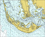
Sanibel Island, 1977
A National Oceanic and Atmospheric Administration map of Sanibel Island current to 1977. This Department of Commerce chart shows all soundings expressed in feet at mean lower low water. Navigational aids such as lights, beacons, buoys and measures of...

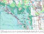
Estero Island, 1985
A portion of the US Geological Survey and National Ocean Service Naples Quadrangle map of the southern Florida current to 1985 showing the area around Estero Island on the Gulf Coast. This topographic-bathymetric map shows elevations and depths in me...

Bonita Springs, 1985
A portion of the US Geological Survey and National Ocean Service Naples Quadrangle map of the southern Florida current to 1985 showing Bonita Springs on the Gulf Coast. This topographic-bathymetric map shows elevations and depths in meters. Contour ...

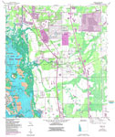
Estero Quadrangle, 1987
A US Coast and Geodetic Survey and National Ocean Service map of the Estero area, current to 1987. This topographic-bathymetric map shows elevations and depths in meters. Contour interval 5 meters. Bathymetric contour interval 1 meters. Map also i...

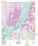
Fort Myers SW, 1987
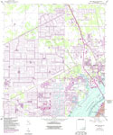
A US Geological Survey and National Ocean Service map of Fort Myers and Cape Coral, current to 1987. The map shows both topographic and bathymetric features. Topographic contour lines are shown in 5-feet intervals and bathymetric contour lines in 1-m...

Fort Myers, 1987
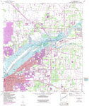
A US Geological Survey and National Ocean Service map of Fort Myers current to 1987. The map shows both topographic and bathymetric features. Topographic contour lines are shown in 5-feet intervals and bathymetric contour lines in 1-meter intervals w...

Fort Myers NW, 1987
A US Geological Survey and National Ocean Service map of Fort Myers current to 1987. The map shows both topographic and bathymetric features. Topographic contour lines are shown in 5-feet intervals and bathymetric contour lines in 1-meter intervals w...

Ft. Myers SW Detail 1, 1987
A US Geological Survey and National Ocean Service detail map of Peppertree Pointe and area, current to 1987. The map shows both topographic and bathymetric features. Topographic contour lines are shown in 5-feet intervals and bathymetric contour line...

Ft. Myers SW Detail 2, 1987
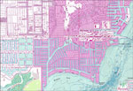
A US Geological Survey and National Ocean Service detail map of Ft. Myers SW, current to 1987. The map shows both topographic and bathymetric features. Topographic contour lines are shown in 5-feet intervals and bathymetric contour lines in 1-meter i...

Ft. Myers SW Detail 3, 1987
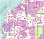
A US Geological Survey and National Ocean Service detail map of the Cape Coral area, current to 1987. The map shows both topographic and bathymetric features. Topographic contour lines are shown in 5-feet intervals and bathymetric contour lines in 1-...

Next Last


  FL Maps > Local > Lee
Site Map  

Maps ETC is a part of the Educational Technology Clearinghouse
Produced by the Florida Center for Instructional Technology © 2007
College of Education , University of South Florida