|
|
|
| FL Maps > County > Sarasota |
Click on a thumbnail image to view a full size version of that map.
Sarasota County is Florida's 60th county, established on May 14, 1921, from a segment of Manatee County. The origins of its name are unclear, but it is likely based on some words from a Native American language. Sarasota is the county seat.
For earlier maps of this area, visit the Manatee County map gallery.
|
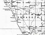
Sarasota County,
1932 |
|
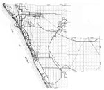
Sarasota,
1936 |
|
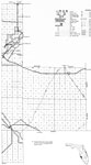
East Sarasota,
1936 |
|
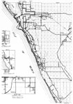
West Sarasota,
1936 |
|
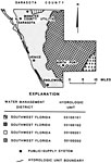
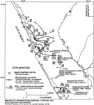
Water Management Districts and Hydrologic Units for Sarasota County,
1981 |
|
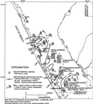
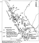
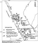
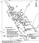
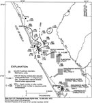
Specific Conductance of Intermediate Aquifer Well Water from Permeable Zone 1 in Southwest Sarasota County,
1996 |
|
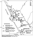
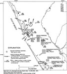
Dissolved Solids Concentration of Intermediate Aquifer Well Water from Permeable Zone 1 in Southwest Sarasota County,
1996 |
|
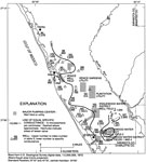
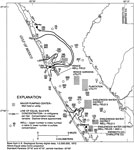
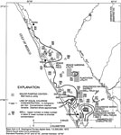
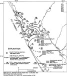
Major Pumping Centers in Southwest Sarasota County,
1996 |
|
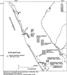
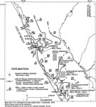
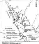
Chloride Concentration of Surficial Aquifer Well Water in Southwest Sarasota County,
1996 |
|
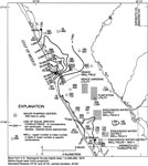
Sulfate Concentration of Surficial Aquifer Well Water in Southwest Sarasota County,
1996 |
|
Dissolved Solids Concentration of Surficial Aquifer Well Water in Southwest Sarasota County,
1996 |
|
Specific Conductance of Surficial Aquifer Well Water in Southwest Sarasota County,
1996 |
|
Chloride Concentration of Intermediate Aquifer Well Water from Permeable Zone 1 in Southwest Sarasota County,
1996 |
|
Sulfate Concentration of Intermediate Aquifer Well Water from Permeable Zone 1 in Southwest Sarasota County,
1996 |
|
Chloride Concentration of Intermediate Aquifer Well Water from Permeable Zone 2 in Southwest Sarasota County,
1996 |
|
Sulfate Concentration of Intermediate Aquifer Well Water from Permeable Zone 2 in Southwest Sarasota County,
1996 |
|
Dissolved Solids Concentration of Intermediate Aquifer Well Water from Permeable Zone 2 in Southwest Sarasota County,
1996 |
|
Specific Conductance of Intermediate Aquifer Well Water from Permeable Zone 2 in Southwest Sarasota County,
1996 |
|
Chloride Concentration of Intermediate Aquifer Well Water from Permeable Zone 3 in Southwest Sarasota County,
1996 |
|
Sulfate Concentration of Intermediate Aquifer Well Water from Permeable Zone 3 in Southwest Sarasota County,
1996 |
|
Dissolved Solids Concentration of Intermediate Aquifer Well Water from Permeable Zone 3 in Southwest Sarasota County,
1996 |
|
Specific Conductance of Intermediate Aquifer Well Water from Permeable Zone 3 in Southwest Sarasota County,
1996 |
|
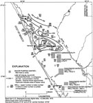
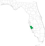
Locater Map of Sarasota County,
2008 |
|
Clipart Collection: Sarasota County Maps in 50 Colors,
2008 |
|
Plain Frames Collection: Sarasota County Maps in 30 Colors,
2008 |
| Next | Last |
| FL Maps > County > Sarasota |
Maps ETC
is a part of the
Educational Technology Clearinghouse
Produced by the
Florida Center for Instructional Technology
© 2007
College of Education
,
University of South Florida