|
|
|
| FL Maps > County > Hardee |
Click on a thumbnail image to view a full size version of that map.
Hardee County is Florida's 55th county, established on April 23, 1921, from a segment of Desoto County. It gains its name from Cary Augustus Hardee, who was serving his first year as Governor at the time of the county's creation. Wauchula is the county seat.
For earlier maps of this area, visit the Desoto County map galleries.
|
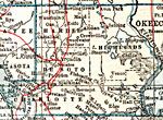
Hardee County,
1921 |
|
Hardee County,
1932 |
|
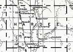
Hardee,
1936 |

|
East Hardee,
1936 |
|
West Hardee,
1936 |
|
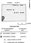
Water Management Districts and Hydrologic Units for Hardee County,
1981 |
|
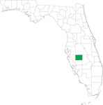
Locater Map of Hardee County,
2008 |

|
Clipart Collection: Hardee County Maps in 50 Colors,
2008 |

|
Plain Frames Collection: Hardee County Maps in 30 Colors,
2008 |
|
Fancy Frames Collection: Hardee County Maps in 30 styles,
2008 |

|
Florida Photo Collection: Hardee County Maps in 30 styles,
2008 |
|
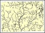
Florida Waterways: Hardee County Outline,
2008 |
|
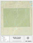
Florida Waterways: Hardee County ,
2008 |
|
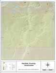
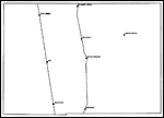
Sinkholes of Hardee County, Florida,
2008 |
|
Florida Waterways: Hardee County Outline without Labels,
2008 |

|
Hardee "Abstract" Style Maps in 30 Styles,
2008 |
|
Hardee County "Fun" Maps in 30 Styles,
2008 |
|
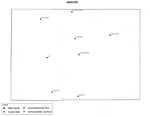
Hardee County Cities with Labels,
2009 |
|
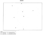
Hardee County Cities Outline,
2009 |
|
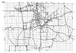
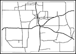
Hardee County Road Network- Black and White,
2009 |
|
Hardee County Railway Network- Black and White,
2009 |
|
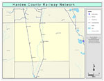
Hardee County Railway Network- Color,
2009 |
|
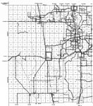
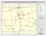
Hardee County Road Network- Color,
2009 |
|
Southwest Florida Water Management District- Hardee County,
September 28, 2004 |
| FL Maps > County > Hardee |
Maps ETC
is a part of the
Educational Technology Clearinghouse
Produced by the
Florida Center for Instructional Technology
© 2007
College of Education
,
University of South Florida