|
|
|
| FL Maps > State > 1740-1759 |
|
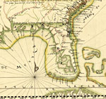
Detail of Facsimile - Descripcion Geografica, de la parte que los Españoles poseen Actualmente en el Continente de la Florida...,
1742 |
|
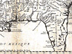
Detail - Carte de la Louisiane cours du Mississipi et pais voisins ,
1744 |
|
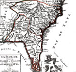
La Floride, divisee en Floride et Caroline,
1749 |
|
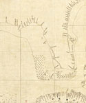
Detail - Descripcion de la costa de Tierra Firme desde el Rio de la Empalizada hasta Cavo de Clara,
1757 |
| FL Maps > State > 1740-1759 |
Maps ETC
is a part of the
Educational Technology Clearinghouse
Produced by the
Florida Center for Instructional Technology
© 2007
College of Education
,
University of South Florida