| Home > Maps > Miami-Dade City and Local > Biscayne Bay, 1861 | |
|
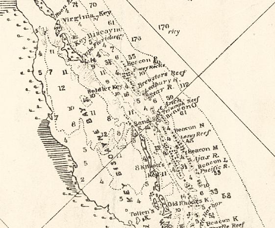
Detailed
view of Biscayne Bay from a preliminary chart for the U.S. Coast Survey
in 1861 of the northeastern part of the Gulf of Mexico.
|
|
Map Credit: Courtesy of the Library of Congress, Geography and Map Division.
|
| Home > Maps > Miami-Dade City and Local > Biscayne Bay, 1861 |
Exploring
Florida: A Social Studies Resource for Students and Teachers
Produced by the Florida Center for Instructional
Technology,
College of Education, University of South Florida © 2002.