| Home > Maps > Escambia City and Local > Pensacola Bay, 1862 | |
|
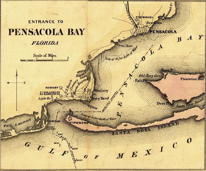
Detail
view of the Pensacola Bay entrance from J.H. Colton's plans of U.S. harbors
drawn in 1862 from U.S. surveys and other authentic sources. The plans
show important fortifications.
|
|
Map Credit: Courtesy of the Library of Congress, Geography and Map Division.
|
| Home > Maps > Escambia City and Local > Pensacola Bay, 1862 |
Exploring
Florida: A Social Studies Resource for Students and Teachers
Produced by the Florida Center for Instructional
Technology,
College of Education, University of South Florida © 2002.