| Home > Maps > Leon City and Local Maps > Aerial View of Tallahassee, 1926 > Tallahassee Detail | |
|
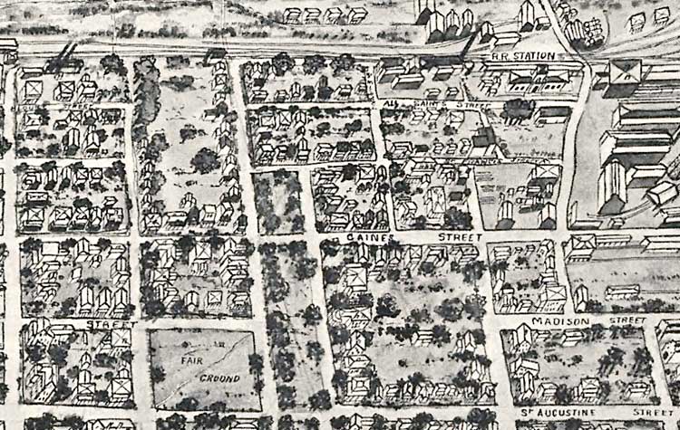
Tallahassee Detail. Area southwest of the Capitol bounded by Duval Street and St. Augustine Street. Also includes the railroad station, All Saints Street, St. Francis Street, Gaines Street, Madison Street, and the fair ground.
|
|
Map Credit: Courtesy of the Library of Congress.
|
| Home > Maps > Leon City and Local Maps > Aerial View of Tallahassee, 1926 > Tallahassee Detail |
Exploring
Florida: A Social Studies Resource for Students and Teachers
Produced by the Florida Center for Instructional
Technology,
College of Education, University of South Florida ©2004.