| Home > Maps > Leon City and Local Maps > Aerial View of Tallahassee, 1926 > Tallahassee Detail | |
|
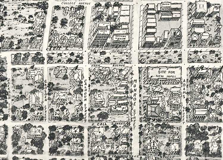
Tallahassee Detail. Area bounded by College Avenue, Duval Street, Tennessee Street, and Jackson Street. Also includes Park Avenue, East Call Street, Gadsden Street, Calhoun Street, Monroe Street, Adams Street, Cherokee Hotel, Western Union, the post office, Elks, and a theater.
|
|
Map Credit: Courtesy of the Library of Congress.
|
| Home > Maps > Leon City and Local Maps > Aerial View of Tallahassee, 1926 > Tallahassee Detail |
Exploring
Florida: A Social Studies Resource for Students and Teachers
Produced by the Florida Center for Instructional
Technology,
College of Education, University of South Florida ©2004.