| Home > Maps > Pinellas City and Local > St. Pete, mid 1900s | |
|
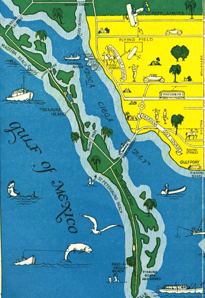
Color
map of various places available for recreational activities in St. Petersburg
during the mid-1900s. Detailed view is of west St. Petersburg and some
beaches.
|
|
Map Credit: Courtesy of the Special Collections Department, University of South Florida. Digitization provided by the USF Libraries Digitization Center.
|
| Home > Maps > Pinellas City and Local > St. Pete, mid 1900s |
Exploring
Florida: A Social Studies Resource for Students and Teachers
Produced by the Florida Center for Instructional
Technology,
College of Education, University of South Florida © 2002.