Exploring Florida History
Home > Photos > Military > Ft. Cooper
Site Map

Gallery: Ft. Cooper

Click on a thumbnail photo to view the full picture.

A wooden milepost marks the directions to Ft. Cooper (1/4 mile), Camp Izzard (12 miles), and Ft. Brooke (60 miles). Ft. Cooper was named for Major Mark Anthony Cooper, who was ordered to protect wounded soldiers after the Second Seminole War. After the fort was built in 1836, he waited there for assistance from other troops.

Large trees have grown in the area.

A reconstructed section of a defensive wall.

A reconstructed section of a defensive wall.

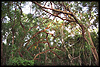
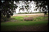
Lake Holathlikaha is located in the center of Ft. Cooper State Park. It was once used by Cooper and his men as a source of drinking water.

Old military road.

"Old military road: This wagon trail led between Ft. Brooke and Ft. King along the west side of the cove of the Withlacochee."


Home > Photos > Military > Ft. Cooper
Site Map

Exploring Florida: Social Studies Resources for Students and Teachers
Produced by the Florida Center for Instructional Technology,
College of Education, University of South Florida © 2002.