Maps Site map
  FL Maps > Local > Gadsden
Site Map  

City and Local Maps for Gadsden County

Click on a thumbnail image to view a full size version of that map.


  Record   1   to   22  of   22

Midway Insert, 1936
This is a detailed map of the city Midway in Gadsden County, Florida. Section Township Range (STR) is shown. This map shows state roads, railroads, churches, tenant houses, a school, a factory, townhall, businesses, farm units and dwellings other tha...

Concord, 1936
This is a detailed map of the city Concord in Gadsden County, Florida. Section Township Range (STR) is shown. This map shows state roads, inland waters, businesses, a school, a post office, churches, cemeteries, townhall, farm units and dwellings oth...

Darcey, 1936
This is a detailed map of the city Darcey in Gadsden County, Florida current to 1936. Section Township Range (STR) is shown. This map shows state roads (94 and 493), US highway (27), businesses, tenant houses, cemeteries, farm units and dwellings oth...

Dogtown, 1936
This is a detailed map of the city Dogtown in Gadsden County, Florida current to 1936. Section Township Range (STR) is shown. This map shows state roads (490 and 12), railroads, cemeteries, churches, schools, businesses, farm units and dwellings othe...

Freemont, 1936
This is a detailed map of the city Freemont in Gadsden County, Florida current to 1936. Section Township Range (STR) is shown. This map shows roads, railroads, churches, tenant houses, a school, businesses, farm units and dwellings other than farms. ...

Greensboro & Juniper, 1936
This is a detailed map of the cities Greensboro and Juniper in Gadsden County, Florida. Section Township Range (STR) is shown. This map shows state roads, railroads, a school, a sawmill, businesses, tenant houses, farm units and dwellings other than ...

Gretna, 1936
This is a detailed map of the city Gretna in Gadsden County, Florida current to 1936. Section Township Range (STR) is shown. This map shows state roads (1 and 488), railroads, churches, a cemetery, a factory, tenant houses, farm units and dwellings o...

Hardaway Insert, 1936
This is a detailed map of the city Hardaway in Gadsden County, Florida current to 1936. Section Township Range (STR) is shown. This map shows graded and drained roads, railroads, churches, a school, businesses, townhall, farm units and dwellings othe...

Hardaway, 1936
This is a detailed map of the city Hardaway in Gadsden County, Florida current to 1936. Section Township Range (STR) is shown. This map shows roads, graded and drained roads, primitive roads, railroads, churches, farm units and dwellings other than f...

Havana, 1936
This is a detailed map of the city Havana in Gadsden County, Florida current to 1936. Section Township Range (STR) is shown. This map shows roads, corporate boundaries, railroads, state roads, a cemetery, a church, a school, a tenant house, farm unit...

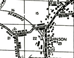
Hinson, 1936
This is a detailed map of the city Hinson in Gadsden County, Florida. Section Township Range (STR) is shown. This map shows railroads, cemeteries, a post office, businesses, tenant houses, camp, a church, a factory, farm units and dwellings other tha...

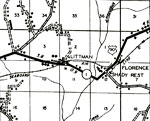
Littman, Florence & Shady Rest, 1936
This is a detailed map of the cities Littman, Florence and Shady Rest in Gadsden County, Florida. Section Township Range (STR) is shown. This map shows state roads, US highway, railroads, churches, tenant houses, a sawmill, camp, farm units and dwell...

Midway, 1936
This is a detailed map of the city Midway in Gadsden County, Florida current to 1936. Section Township Range (STR) is shown. This map shows state roads, railroads, inland water, a church, a school, a business, farm units and dwellings other than farm...

Mount Pleasant, 1936
This is a detailed map of the city Mount Pleasant in Gadsden County, Florida current to 1936. Section Township Range (STR) is shown. This map shows graded and drained roads, primitive roads, railroads, townhall, farm units and dwellings other than fa...

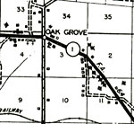
Oak Grove, 1936
This is a detailed map of the city Oak Grove in Gadsden County, Florida current to 1936. Section Township Range (STR) is shown. This map shows graded and drained roads, paved roads, railroads, tenant houses, churches, a school, farm units and dwellin...

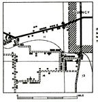
Quincy Insert, 1936
This is a detailed map of the city Quincy in Gadsden County, Florida current to 1936. Section Township Range (STR) is shown. This map shows paved roads, primitive roads, railroads, churches, businesses, turpentine stills, county seat, farm units and ...

River Junction, 1936
This is a detailed map of the city River Junction in Gadsden County, Florida. Section Township Range (STR) is shown. This map shows state roads, US highway, railroads, a factory, a school, a church, townhall, tenant house, a business, farm units and ...

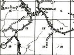
Rosedale, 1936
This is a detailed map of the city Rosedale in Gadsden County, Florida current to 1936. Section Township Range (STR) is shown. This map shows state roads, inland water, graded and drained roads, churches, cemeteries, a business, a school, farm units...

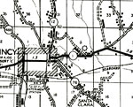
Santa Clara, 1936
This is a detailed map of the city Santa Clara in Gadsden County, Florida. Section Township Range (STR) is shown. This map shows state roads, railroads, an airport, a school, a church, a cemetery, tenant houses, businesses, farm units and dwellings o...

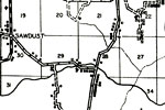
Sawdust, 1936
This is a detailed map of the city Sawdust in Gadsden County, Florida current to 1936. Section Township Range (STR) is shown. This map shows graded and drained roads, inland water, tenant houses, businesses, a church, farm units and dwellings other t...

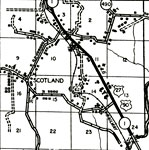
Scotland, 1936
This is a detailed map of the city Scotland in Gadsden County, Florida. Section Township Range (STR) is shown. This map shows state roads, US highways, railroads, churches, camps, a factory, businesses, schools, a cemetery, townhall, tenant houses, f...

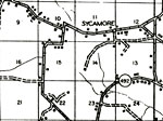
Sycamore, 1936
This is a detailed map of the city Sycamore in Gadsden County, Florida current to 1936. Section Township Range (STR) is shown. This map shows state roads, graded and drained roads, paved roads, churches, a school, townhall, farm units and dwellings o...


  FL Maps > Local > Gadsden
Site Map  

Maps ETC is a part of the Educational Technology Clearinghouse
Produced by the Florida Center for Instructional Technology © 2007
College of Education , University of South Florida