Maps Site map
  FL Maps > Local > Leon
Site Map  

City and Local Maps for Leon County

Click on a thumbnail image to view a full size version of that map.

  Record   1   to   25  of   51

Detail - Map of Florida, 1850
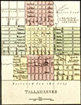
This is a detail of a map that shows Florida current to 1850. The detail highlights Tallahasee with the text "Reserved for the City." There are streets depicted, as well as Gov. Duval's residence. Minor waterways are shown, such as springs,...

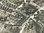
View of the city of Tallahassee, State capital of Florida, 1885
An aerial view of the City of Tallahassee, the State Capital of Florida in 1885. Perspective map not drawn to scale. General topography of the city is shown in this bird's-eye-view, along with agricultural lands and groves, the Capital Building, othe...

Detail View of the city of Tallahassee, State capital of Florida, 1885
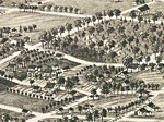
A detail from an aerial view of the City of Tallahassee, the State Capital of Florida in 1885. View includes (1) the Capitol Building; (12) "The Morgan," Geo. C Morgan, Prop.; (29) M. Lively, Drugs and Medicines; (30) R. & J. Munroe, General Merchand...

Detail View of the city of Tallahassee, State capital of Florida, 1885
A detail from an aerial view of the City of Tallahassee, the State Capital of Florida in 1885. View includes (27) The Tallahassee Real Estate Exchange; (37) R. W. Williams, Attorney at Law; (25) The Economist Office; (32) Y. A. Levy, General Merchand...

Detail View of the city of Tallahassee, State capital of Florida, 1885
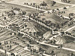
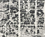
A detail from an aerial view of the City of Tallahassee, the State Capital of Florida in 1885. View includes (14) Episcopal Church; (34) Geo. P. Raney, Judge Circuit Court; (40) Geo. W. Betton, M. D.; and (43) Geo. Lewis' Residence. Perspective map ...

Detail View of the city of Tallahassee, State capital of Florida, 1885
A detail from an aerial view of the City of Tallahassee, the State Capital of Florida in 1885. View includes (6) University Library; (15) Presbyterian Church; and (31) Cole S. Dickenson, General Merchandise. Perspective map not drawn to scale....

Detail View of the city of Tallahassee, State capital of Florida, 1885
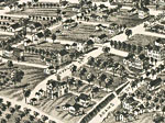
A detail from an aerial view of the City of Tallahassee, the State Capital of Florida in 1885. View includes (8) Masonic and I. O. O. F. Hall; (16) Methodist Church; and (20) Colored Baptist Churches. Perspective map not drawn to scale....

Detail View of the city of Tallahassee, State capital of Florida, 1885
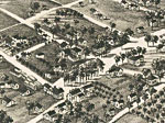
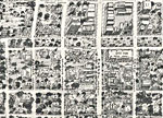
A detail from an aerial view of the City of Tallahassee, the State Capital of Florida in 1885. View includes Bronough Street, Boulevard Street, Macome Street, and Tennessee Street. Perspective map not drawn to scale....

Detail View of the city of Tallahassee, State capital of Florida, 1885
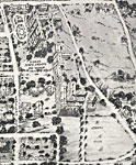
A detail from an aerial view of the City of Tallahassee, the State Capital of Florida in 1885. View includes (3) University of Florida, (5) the Lincoln Academy, Copeland Street, and Macomb Street. Perspective map not drawn to scale....

Detail View of the city of Tallahassee, State capital of Florida, 1885
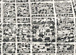
A detail from an aerial view of the City of Tallahassee, the State Capital of Florida in 1885. View includes Boulevard Street and Bronough Street. Perspective map not drawn to scale....

Detail View of the city of Tallahassee, State capital of Florida, 1885
A detail from an aerial view of the City of Tallahassee, the State Capital of Florida in 1885. View includes Duval Street, Adams Street, and Bronough Street. Perspective map not drawn to scale....

Detail View of the city of Tallahassee, State capital of Florida, 1885
A detail from an aerial view of the City of Tallahassee, the State Capital of Florida in 1885. View includes (48) D. Cook's Residence, St. Augustine Street, Madison Street, Calhoun Street, and Gadsden Street. Perspective map not drawn to scale....

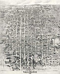
An Aero-View of Tallahassee, 1926
An aero-view of the City of Tallahassee, the State Capital of Florida in 1926. This map orientation is from north to south, looking toward the Gulf of Mexico. From this point of view, south is toward the horizon. Perspective map not drawn to scale. G...

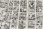
Detail from an Aero-View of Tallahassee, 1926
A detail from an aero-view of the City of Tallahassee, the State Capital of Florida in 1926. This map orientation is from north to south, looking toward the Gulf of Mexico. From this point of view, south is toward the top of the map. View includes th...

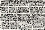
Detail from an Aero-View of Tallahassee, 1926
A detail from an aero-view of the City of Tallahassee, the State Capital of Florida in 1926. This map orientation is from north to south, looking toward the Gulf of Mexico. From this point of view, south is toward the top of the map. View includes th...

Detail from an Aero-View of Tallahassee, 1926
A detail from an aero-view of the City of Tallahassee, the State Capital of Florida in 1926. This map orientation is from north to south, looking toward the Gulf of Mexico. From this point of view, south is toward the top of the map. View includes th...

Detail from an Aero-View of Tallahassee, 1926
A detail from an aero-view of the City of Tallahassee, the State Capital of Florida in 1926. This map orientation is from north to south, looking toward the Gulf of Mexico. From this point of view, south is toward the top of the map. View includes th...

Detail from an Aero-View of Tallahassee, 1926
A detail from an aero-view of the City of Tallahassee, the State Capital of Florida in 1926. This map orientation is from north to south, looking toward the Gulf of Mexico. From this point of view, south is toward the top of the map. The view include...

Detail from an Aero-View of Tallahassee, 1926
A detail from an aero-view of the City of Tallahassee, the State Capital of Florida in 1926. This map orientation is from north to south, looking toward the Gulf of Mexico. From this point of view, south is toward the top of the map. View includes th...

Detail from an Aero-View of Tallahassee, 1926
A detail from an aero-view of the City of Tallahassee, the State Capital of Florida in 1926. This map orientation is from north to south, looking toward the Gulf of Mexico. From this point of view, south is toward the top of the map. View includes th...

Next Last


  FL Maps > Local > Leon
Site Map  

Maps ETC is a part of the Educational Technology Clearinghouse
Produced by the Florida Center for Instructional Technology © 2007
College of Education , University of South Florida