Maps Site map
  FL Maps > Local > Polk
Site Map  

City and Local Maps for Polk County

Click on a thumbnail image to view a full size version of that map.


  Record   1   to   25  of   42

Section of the Lake Buffum Summit Level, 1884
This is a map showing a section of the Lake Buffum summit level, circa 1884. It shows water depth along the Lake Buffum Summit Level....

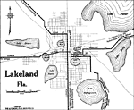
Lakeland Florida, 1919
Map of Lakeland, Florida in 1919 C.E. Map shows local roads and railroads around Lakeland. Shows all lakes that surround Lakeland including Lake Parker, Lake Bonnet, Lake Bony, and Lake Hunter. ...

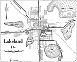
Lakeland Florida, 1922
Map of Lakeland, Florida in 1922 C.E. Map shows local roads and railroads around Lakeland. Shows all lakes that surround Lakeland...

Agricola, Florida, 1927
A section of the Soil Map for Polk County produced by the United States Department of Agriculture, Bureau of Chemistry and Soils in conjunction with the Florida State Geological Survey. This map shows roads, railroads, and the major soil groups foun...

Alturas, Florida, 1927
A section of the Soil Map for Polk County produced by the United States Department of Agriculture, Bureau of Chemistry and Soils in conjunction with the Florida State Geological Survey. This map shows roads, railroads, and the major soil groups foun...

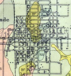
Auburndale, Florida, 1927
A section of the Soil Map for Polk County produced by the United States Department of Agriculture, Bureau of Chemistry and Soils in conjunction with the Florida State Geological Survey. This map shows roads, railroads, and the major soil groups foun...

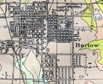
Bartow, Florida., 1927
A section of the Soil Map for Polk County produced by the United States Department of Agriculture, Bureau of Chemistry and Soils in conjunction with the Florida State Geological Survey. This map shows roads, railroads, and the major soil groups foun...

Bradley Junction, Florida., 1927
A section of the Soil Map for Polk County produced by the United States Department of Agriculture, Bureau of Chemistry and Soils in conjunction with the Florida State Geological Survey. This map shows roads, railroads, and the major soil groups foun...

Brewster, Florida., 1927
A section of the Soil Map for Polk County produced by the United States Department of Agriculture, Bureau of Chemistry and Soils in conjunction with the Florida State Geological Survey. This map shows roads, railroads, and the major soil groups foun...

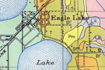
Eagle Lake, Florida, 1927
A section of the Soil Map for Polk County produced by the United States Department of Agriculture, Bureau of Chemistry and Soils in conjunction with the Florida State Geological Survey. This map shows roads, railroads, and the major soil groups foun...

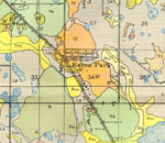
Eaton Park, Florida, 1927
A section of the Soil Map for Polk County produced by the United States Department of Agriculture, Bureau of Chemistry and Soils in conjunction with the Florida State Geological Survey. This map shows roads, railroads, and the major soil groups foun...

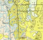
Flanders, Florida, 1927
A section of the Soil Map for Polk County produced by the United States Department of Agriculture, Bureau of Chemistry and Soils in conjunction with the Florida State Geological Survey. This map shows roads, railroads, and the major soil groups foun...

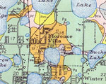
Florence Villa, Florida, 1927
A section of the Soil Map for Polk County produced by the United States Department of Agriculture, Bureau of Chemistry and Soils in conjunction with the Florida State Geological Survey. This map shows roads, railroads, and the major soil groups foun...

Fort Mead, Florida, 1927
A section of the Soil Map for Polk County produced by the United States Department of Agriculture, Bureau of Chemistry and Soils in conjunction with the Florida State Geological Survey. This map shows roads, railroads, and the major soil groups foun...

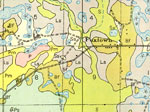
Foxtown, Florida, 1927
A section of the Soil Map for Polk County produced by the United States Department of Agriculture, Bureau of Chemistry and Soils in conjunction with the Florida State Geological Survey. This map shows roads, railroads, and the major soil groups foun...

Gibsonia, Florida, 1927
A section of the Soil Map for Polk County produced by the United States Department of Agriculture, Bureau of Chemistry and Soils in conjunction with the Florida State Geological Survey. This map shows roads, railroads, and the major soil groups foun...

Gordonville, Florida, 1927
A section of the Soil Map for Polk County produced by the United States Department of Agriculture, Bureau of Chemistry and Soils in conjunction with the Florida State Geological Survey. This map shows roads, railroads, and the major soil groups foun...

Homeland, Florida, 1927
A section of the Soil Map for Polk County produced by the United States Department of Agriculture, Bureau of Chemistry and Soils in conjunction with the Florida State Geological Survey. This map shows roads, railroads, and the major soil groups foun...

Inwood, Florida, 1927
A section of the Soil Map for Polk County produced by the United States Department of Agriculture, Bureau of Chemistry and Soils in conjunction with the Florida State Geological Survey. This map shows roads, railroads, and the major soil groups foun...

Lake Alfred, Florida, 1927
A section of the Soil Map for Polk County produced by the United States Department of Agriculture, Bureau of Chemistry and Soils in conjunction with the Florida State Geological Survey. This map shows roads, railroads, and the major soil groups foun...

Lake Garfield, Florida, 1927
A section of the Soil Map for Polk County produced by the United States Department of Agriculture, Bureau of Chemistry and Soils in conjunction with the Florida State Geological Survey. This map shows roads, railroads, and the major soil groups foun...

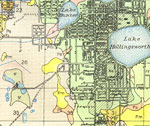
Lakeland North, Florida, 1927
A section of the Soil Map for Polk County produced by the United States Department of Agriculture, Bureau of Chemistry and Soils in conjunction with the Florida State Geological Survey. This map shows roads, railroads, and the major soil groups foun...

Lakeland South, Florida, 1927
A section of the Soil Map for Polk County produced by the United States Department of Agriculture, Bureau of Chemistry and Soils in conjunction with the Florida State Geological Survey. This map shows roads, railroads, and the major soil groups foun...

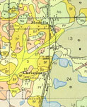
Medula and Christina, Florida, 1927
A section of the Soil Map for Polk County produced by the United States Department of Agriculture, Bureau of Chemistry and Soils in conjunction with the Florida State Geological Survey. This map shows roads, railroads, and the major soil groups foun...

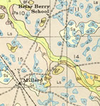
Millard and Briar Berry School, Florida, 1927
A section of the Soil Map for Polk County produced by the United States Department of Agriculture, Bureau of Chemistry and Soils in conjunction with the Florida State Geological Survey. This map shows roads, railroads, and the major soil groups foun...

Next Last


  FL Maps > Local > Polk
Site Map  

Maps ETC is a part of the Educational Technology Clearinghouse
Produced by the Florida Center for Instructional Technology © 2007
College of Education , University of South Florida