Maps Site map
  FL Maps > Region > 1920-1949
Site Map  

  Record   26   to   26  of   26

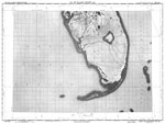
Lake Okeechobee, 1948
An U.S. Air Force Aeronautical Chart Service map of Lake Okeechobee current to1948. This Radar chart shows Lake Okeechobee and surrounding cities and towns, including adjacent territory. The map scale is 1:1,000,000. N.O.A.A. map reference: 525-1-19...

First Previous


  FL Maps > Region > 1920-1949
Site Map  

Maps ETC is a part of the Educational Technology Clearinghouse
Produced by the Florida Center for Instructional Technology © 2007
College of Education , University of South Florida