| 
|
1802,
A map exhibiting all the new discoveries in the interior parts of North America : inscribed by permission to the honourable governor and company of adventurers of England trading into Hudsons Bay in testimony of their liberal communications to their most obedient and very humble servant A. Arrowsmith, January 1st 1795. |
| 
|
1803,
A map of North America ; Outline of North America, in correspond to
the map. |
| 
|
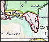
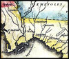
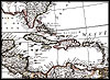
1806,
A map of the West Indies and of the Mexican-Gulph [sic]. |
| 
|
1806,
A map of the West Indies and of the Mexican-Gulph [sic]. |
| 
|
1806,
A map of the West Indies and of the Mexican-Gulph [sic]. |
| 
|
1806,
A map of the West Indies and of the Mexican-Gulph [sic]. |
 |
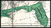
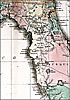
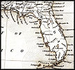
A
view of East Florida from an 1806 map of the southeastern United States. |
 |
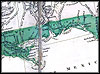
A
view of West Florida from an 1806 map of the southeastern United States. |
| 
|
1809,
Bahia de Tampa, Published by Madrid, Dericcin de Hidrografa. |
| 
|
1809,
Bahia de Tampa, Published by Madrid, Dericcin de Hidrografa. |
| 
|
1816,
Map of the United States of America : with the contiguous British and
Spanish possessions / compiled from the latest & best authorities by
John Melish. |
| 
|
1816,
Map of the United States of America : with the contiguous British and
Spanish possessions / compiled from the latest & best authorities by
John Melish. |
| 
|
1816,
Map of the United States of America : with the contiguous British and
Spanish possessions / compiled from the latest & best authorities by
John Melish. |
| 
|
1816,
Map of the United States of America : with the contiguous British and
Spanish possessions / compiled from the latest & best authorities by
John Melish. |
| 
|
1816,
Map of the United States of America : with the contiguous British and
Spanish possessions / compiled from the latest & best authorities by
John Melish. |
| 
|
1816,
Map of the United States of America : with the contiguous British and
Spanish possessions / compiled from the latest & best authorities by
John Melish. |
|
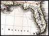
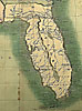
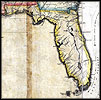
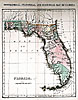
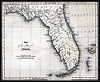
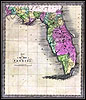
circa 1825, Geographical, Statistical, and Historical Map of Florida.  |
 |
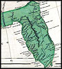
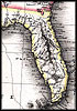
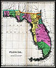
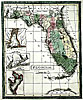
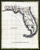
Geographical,
statistical, and historical map of Florida from 1826. |
 |
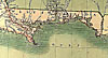
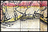
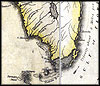
A
view of the Florida panhandle area from a geographical, statistical, and
historical map of Florida from 1826. |
 |
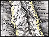
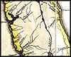
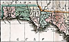
A
view of northern Florida from a geographical, statistical, and historical
map of Florida from 1826. |
|
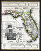
1832, I.T. Hinton & Simpkin & Marshall Map. |
 |
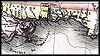
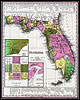
An
1834 map of Florida with inserts of Mobile, Perdido, Pensacola, and Espirito
Santo Bays. |
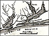 |
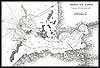
Detail
from an 1834 map of Florida focusing
on Perdido and Pensacola Bays. |
| 
|
1835,
United States. |
| 
|
1835,
United States. |
|
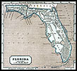
1835, Map of Florida. |
|
1839, Map of Florida that was, "Entered according to Act of Congress
in the year 1839 by H. S. Tanner in the clerks office of the eastern
district of Pennsylvania." |
|
1842, Green Leaf Map. |
|
1845, Aus der Gravisanstalt des Bibliographischan Instituts zu.
Hillsburghaus Amsterdam Paris u. Philadelphia Map. |
 |
1845,
Sidney E. Morse map. |