| Home > Maps > 1800s > Florida 1839 | |
|
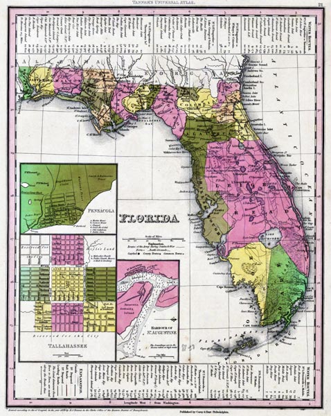
1839,
Map of Florida that was, "Entered according to Act of Congress in the year 1839 by H. S. Tanner in the clerks office of the eastern district of Pennsylvania."
 |
|
Map Credit: Courtesy of the private collection of Roy Winkelman.
|
| Home > Maps > 1800s > Florida 1839 |
Exploring
Florida: A Social Studies Resource for Students and Teachers
Produced by the Florida Center for Instructional
Technology,
College of Education, University of South Florida © 2002.