|
|
|
| FL Maps > Other Florida Hurricane Maps |
|
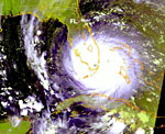
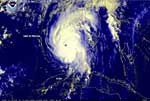
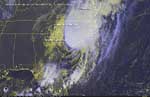
Hurricane Andrew,
August 24, 1992 |
|
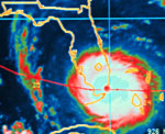
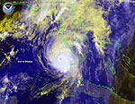
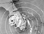
Hurricane Andrew,
August 24, 1992 |
|
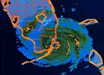
Hurricane Andrew in Dade County,
August 24, 1992 |
|
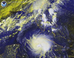
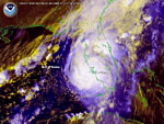
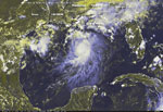
Hurricane Charley,
August 12, 2004 |
|
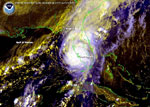
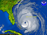
Hurricane Charley Approaching Florida,
August 13, 2004 |
|
Hurricane Charley Approaching Florida,
August 13, 2004 |
|
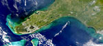
Hurricane Charley Approaching Ft. Myers,
August 13, 2004 |
|
Hurricane Charley Making Landfall,
August 13, 2004 |
|
Hurricane Charley Making Landfall Again,
August 14, 2004 |
|
Hurricane Donna,
September 10, 1960 |
|
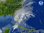
Hurricane Floyd,
September 14, 1999 |
|
Hurricane Irene After-Effects,
October 18, 1999 |
|
Tropical Storm Bonnie,
August 11, 2004 |
|
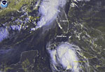
Tropical Storm Bonnie and Hurricane Charley,
August 12, 2004 |
|
Tropical Storm Gabrielle,
September 14, 2001 |
|
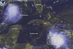
Tropical Storms Bonnie and Charley,
August 11, 2004 |
| FL Maps > Other Florida Hurricane Maps |
Maps ETC
is a part of the
Educational Technology Clearinghouse
Produced by the
Florida Center for Instructional Technology
© 2009
College of Education
,
University of South Florida