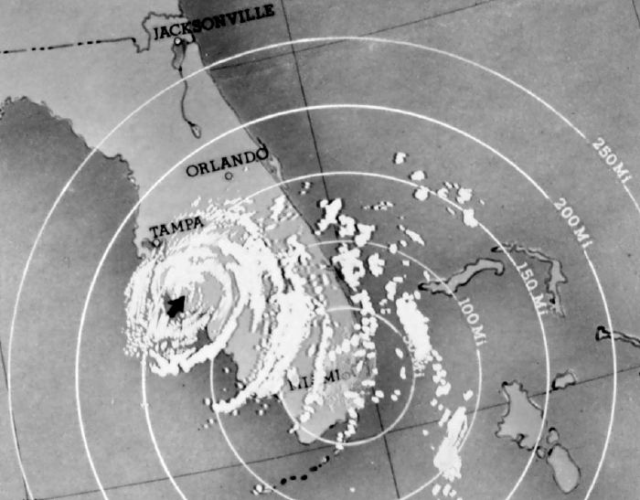
Description: This is a photo of a radar tracking Hurricane Donna on September 10, 1960 at 6:00 PM EST over the state of Florida. The eye is indicated by an arrow.
Place Names: 1950-1999, Jacksonville, Orlando, Tampa, Miami
ISO Topic Categories: climatologyMeteorologyAtmosphere, oceans, boundaries
Keywords: Hurricane Donna, physical, hurricane, khurricane, kradar, political, meteorological, country borders, climatologyMeteorologyAtmosphere, oceans, boundaries, Unknown,September 10, 1960
Source: National Oceanic and Atmospheric Administration, (Washington , DC: U. S. Department of Commerce, 1960)
Map Credit: Courtesy the U.S. National Oceanic and Atmospheric Administration |
|