| Home > Maps > 1800s, III > South Florida 1890s | |
|
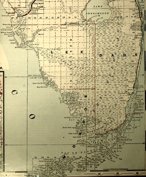
Map
of Florida created during the 1890s that also indicates train routes of
various rail companies. Detailed view of south Florida.
|
|
Map Credit: Courtesy of the Special Collections Department, University of South Florida. Digitization provided by the USF Libraries Digitization Center.
|
| Home > Maps > 1800s, III > South Florida 1890s |
Exploring
Florida: A Social Studies Resource for Students and Teachers
Produced by the Florida Center for Instructional
Technology,
College of Education, University of South Florida © 2002.