| Home > Maps > Aerial > Satellite Photo of Florida | |
|
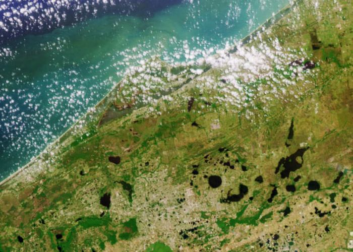
Multi-angle
Imaging SpectroRadiometer (MISR) images of Florida acquired on April 9,
2000 during Terra orbit 1650. The image at the top is a color view acquired
by the vertical (nadir) camera. It has been reoriented so that the flight
path is from left to right, to facilitate comparison with the lower image,
a stereo anaglyph generated using 275-m resolution red band data from
the cameras viewing 45.6 degrees and 70.5 degrees aft of nadir. The anaglyph
provides a three-dimensional effect when viewed using red/blue glasses
with the red filter placed over the left eye. This stereoscopic "depth
perception" and the variation in brightness as a function of view angle
enables scientists to assess the climate impact of different types of
cloud fields. The plume from a large brush fire that burned about 15,000
acres is visible at the western edge of the Big Cypress Swamp in southern
Florida.
|
|
Map Credit: Courtesy of NASA/GSFC/JPL, MISR Science Team.
|
| Home > Maps > Aerial > Satellite Photo of Florida |
Exploring
Florida: A Social Studies Resource for Students and Teachers
Produced by the Florida Center for Instructional
Technology,
College of Education, University of South Florida © 2002.