 |
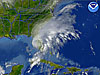
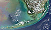
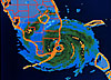
Tropical
Storm Gabrielle on September 14, 2001. |
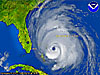 |
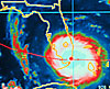
Hurricane
Floyd on September 14, 1999. |
 |
Hurricane
Andrew on August 24, 1992. |
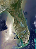 |
Florida
fires on May 19, 2001. |
 |
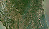
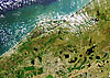
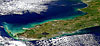
Detail
of southern Florida from a satellite photo taken May 19, 2000. |
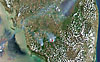 |
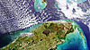
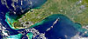
Detail
of Florida Keys from a satellite photo taken May 19, 2000. |
 |
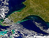
Detail
of south central Florida from a satellite photo taken May 19, 2000. |
 |
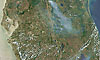
Detail
of north central Florida from a satellite photo taken May 19, 2000. |
 |
Detail
of northern Florida from a satellite photo taken May 19, 2000. |
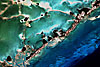 |
An
image of the coral community at Plantation Key. |
 |
An
image of the coral community in the Florida Keys. |
 |
An
image of the coral community on US Highway 1. |
 |
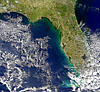
Satellite
photo of Florida taken on April 9, 2000. |
 |
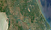
Detail
of east central Florida from a satellite photo taken on April 9, 2000. |
 |
Detail
of southern Florida from a satellite photo taken on April 9, 2000. |
 |
Smoke
plume from Florida fires. |
 |
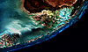
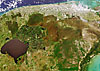
Image
of a large fire that appears in or near Florida's Big Cypress Swamp. |
 |
Cape
Canaveral plume in 1999. |
 |
After-effects
of Hurricane Irene. |
 |
Image
of Kennedy Space Center. |
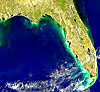 |
Red
tide conditions along the Gulf coast of Florida and Louisiana. |
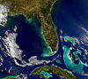 |
Map
of Southern Florida, Cuba, and the Bahamas. |
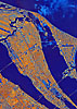 |
Radar
image of the Cape Canaveral area from October 4, 1994. |
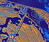 |
Detail
view of Kennedy Space Center from a radar image of the Cape Canaveral
area. |
 |
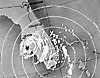
An
infrared satellite image of Hurricane Andrew making landfall in Dade County
on August 24, 1992. |
 |
Hurricane
Andrew making landfall in Dade County. |
 |
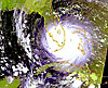
Image
pointing out the eye of Hurricane Donna. |
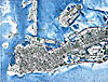 |
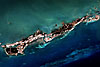
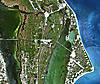
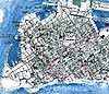
Orthophoto
map of Key West in 1971. |
|
|
Detail
of the western end of Key West from a 1971 orthophoto map.
|