| Home > Maps > Aerial > Smoke Plume | |
|
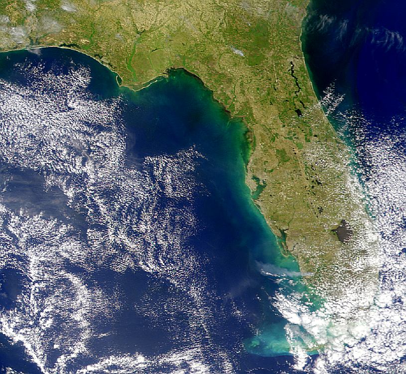
Wind is blowing directly westward in this SeaWiFS image, carrying the smoke plume from fires in Florida out over the Gulf of Mexico. The plume appears to be about 150 kilometers long. Another possible plume can be seen in the northern part of the state.
|
|
Map Credit: Courtesy of the SeaWiFS Project, NASA/Goddard Space Flight Center, and ORBIMAGE.
|
| Home > Maps > Aerial > Smoke Plume |
Exploring
Florida: A Social Studies Resource for Students and Teachers
Produced by the Florida Center for Instructional
Technology,
College of Education, University of South Florida © 2002.