| Home > Maps > Aerial > Hurricane Irene | |
|
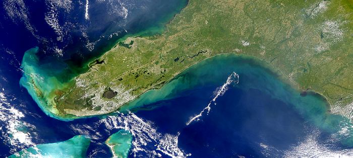
A
SeaWiFS image showing stirred up water and excess runoff along the coast
from the Florida Keys to the Carolinas, the after-effects of Hurricane
Irene, on October 18, 1999.
|
|
Map Credit: Courtesy of the SeaWiFS Project, NASA/Goddard Space Flight Center, and ORBIMAGE.
|
| Home > Maps > Aerial > Hurricane Irene |
Exploring
Florida: A Social Studies Resource for Students and Teachers
Produced by the Florida Center for Instructional
Technology,
College of Education, University of South Florida © 2002.