| Home > Maps > Aerial > Key West | |
|
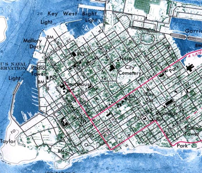
Detailed
view of an orthophoto map of the west end of Key West created in 1971
by the United States Geological Survey.
|
|
Map Credit: Courtesy of the United States Geological Survey.
|
| Home > Maps > Aerial > Key West |
Exploring
Florida: A Social Studies Resource for Students and Teachers
Produced by the Florida Center for Instructional
Technology,
College of Education, University of South Florida © 2002.