|
|
|
| FL Maps > County > Charlotte |
Click on a thumbnail image to view a full size version of that map.
Charlotte County is Florida's 57th county, established on April 23, 1921, from a segment of DeSoto County. It gains its name from Charlotte Harbor. The name Charlotte may be derived from a corruption of the word Calusa, an Indian tribe found in that area. Punta Gorda, whose name means wide or fat point in Spanish, is the county seat. This refers to an arm of land that juts into Charlotte Bay.
For earlier maps of this area, visit the DeSoto County map gallery.
|
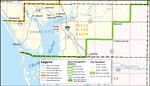
Southwest Florida Water Management District- Charlotte County,
September 28, 2004 |
| First | Previous |
| FL Maps > County > Charlotte |
Maps ETC
is a part of the
Educational Technology Clearinghouse
Produced by the
Florida Center for Instructional Technology
© 2007
College of Education
,
University of South Florida