Maps Site map
  FL Maps > Local > Okaloosa
Site Map  

City and Local Maps for Okaloosa County

Click on a thumbnail image to view a full size version of that map.


  Record   1   to   25  of   26

Baker Insert, 1936
This is a detailed map of the city Baker in Okaloosa County, Florida. Section Township Range (STR) is shown. This map shows state roads, businesses, post offices, a hotel, a school, churches, turpentine still, farm units and dwellings other than farm...

Baker, 1936
This is a detailed map of the city Baker in Okaloosa County, Florida. Section Township Range (STR) is shown. This map shows state roads, churches, cemeteries, a factory, businesses, a sawmill, farm units and dwellings other than farms.

Blackman, 1936
This is a detailed map of the city Blackman in Okaloosa County, Florida. Section Township Range (STR) is shown. This map shows state roads, schools, a church, a business, farm units and dwellings other than farms. Key to...

Crestview, 1936
This is a detailed map of the city Crestview in Okaloosa County, Florida. Section Township Range (STR) is shown. This map shows state roads, US highways, county seat, railroads, businesses, emergency field, turpentine still, camp, farm units and dwel...

Destin, 1936
This is a detailed map of the city Destin in Okaloosa County, Florida. Section Township Range (STR) is shown. This map shows state roads, US highways, businesses, seasonal dwellings, a church, a post office, farm units and dwellings other than farms....

Dorcas, 1936
This is a detailed map of the city Dorcas in Okaloosa County, Florida. Section Township Range (STR) is shown. This map shows state roads, US highways, railroads, schools, a business, a cemetery, farm units and dwellings other than farms.

Escambia Farms, 1936
This is a detailed map of the city Escambia Farms in Okaloosa County, Florida. Section Township Range (STR) is shown. This map shows state roads, forest ranger lookout station, cemeteries, schools, a church, businesses, farm units and dwellings other...

Falco, 1936
This is a detailed map of the city Falco in Okaloosa County, Florida. Section Township Range (STR) is shown. This map shows state roads, railroads, schools, churches, cemeteries, a business, turpentine still, farm units and dwellings other than farms...

Florosa, 1936
This is a detailed map of the city Florosa in Okaloosa County, Florida. Section Township Range (STR) is shown. This map shows state roads, US highways, seasonal dwellings, a hotel, a post office, a playground, a camp, farm units and dwellings other t...

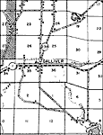
Galliver, 1936
This is a detailed map of the city Galliver in Okaloosa County, Florida. Section Township Range (STR) is shown. This map shows state roads, railroads, businesses, sawmill, farm units and dwellings other than farms. Key t...

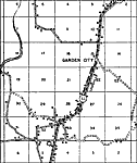
Garden City, 1936
This is a detailed map of the city Garden City in Okaloosa County, Florida. Section Township Range (STR) is shown. This map shows state roads, railroads, an airport, businesses, schools, churches, farm units and dwellings other than farms.

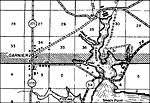
Garnier, 1936
This is a detailed map of the city Garnier in Okaloosa County, Florida. Section Township Range (STR) is shown. This map shows state roads, US highways, seasonal dwellings, businesses, hotels, post offices, a church, a school, turpentine still, forest...

Garnier 2, 1936
This is a detailed map of the city Garnier in Okaloosa County, Florida. Section Township Range (STR) is shown. This map shows state roads, a post office, a school, businesses, a camp, forest ranger lookout station, turpentine still, farm units and dw...

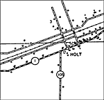
Holt Insert, 1936
This is a detailed map of the city Holt in Okaloosa County, Florida. Section Township Range (STR) is shown. This map shows state roads, railroads, businesses, a school, churches, farm units and dwellings other than farms. Ke...

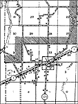
Holt, 1936
This is a detailed map of the city Holt in Okaloosa County, Florida. Section Township Range (STR) is shown. This map shows state roads, US highways, railroads, businesses, farm units and dwellings other than farms. Key t...

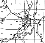
Milligan, 1936
This is a detailed map of the city Milligan in Okaloosa County, Florida. Section Township Range (STR) is shown. This map shows state roads, US highways, railroads, businesses, a church, a school, a post office, a cemetery, sawmill, farm units and dwe...

Oak Grove, 1936
This is a detailed map of the city Oak Grove in Okaloosa County, Florida. Section Township Range (STR) is shown. This map shows state roads, churches, cemeteries, businesses, farm units and dwellings other than farms. Key

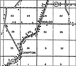
Okaloo, 1936
This is a detailed map of the city Okaloo in Okaloosa County, Florida. Section Township Range (STR) is shown. This map shows state roads, a business, a cemetery, a church, farm units and dwellings other than farms. Key t...

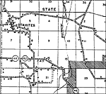
Otahites, 1936
This is a detailed map of the city Otahites in Okaloosa County, Florida. Section Township Range (STR) is shown. This map shows state roads, schools, tenant house, a church, forest ranger lookout station, sawmill, farm units and dwellings other than f...

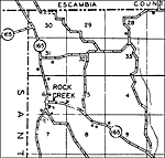
Rock Creek, 1936
This is a detailed map of the city Rock Creek in Okaloosa County, Florida. Section Township Range (STR) is shown. This map shows state roads, a school, a cemetery, farm units and dwellings other than farms. Key to Florid...

Seva, 1936
This is a detailed map of the city Seva in Okaloosa County, Florida. Section Township Range (STR) is shown. This map shows state roads, churches, a cemetery, a pumping station, a business, farm units and dwellings other than farms.

Valpariso, 1936
This is a detailed map of the city Valpariso in Okaloosa County, Florida. Section Township Range (STR) is shown. This map shows state roads, businesses, a camp, a cemetery, farm units and dwellings other than farms. Key ...

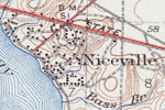
Niceville, 1936
This is a map of Niceville in Okaloosa County, Florida courtesy of the Pennsylvania State University map library. It shows elevation, roads, inland waters, streams and locations of dwellings and churches. Detail view from a United States Geological S...

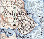
Valparaiso, 1936
This is a map of Valparaiso in Okaloosa County, Florida courtesy of the Pennsylvania State University map library. It shows elevation, roads, inland waters such as Toms Bayou and locations of dwellings and a church. Detail view from a United States G...

Fort Walton, 1938
This is a map of Fort Walton in Okaloosa County, Florida courtesy of the Pennsylvania State University map library. It shows elevation, roads, inland waters, Gulf of Mexico and locations of dwellings, churches, a school, a cemetery and a lighthouse o...

Next Last


  FL Maps > Local > Okaloosa
Site Map  

Maps ETC is a part of the Educational Technology Clearinghouse
Produced by the Florida Center for Instructional Technology © 2007
College of Education , University of South Florida