Maps Site map
  FL Maps > Local > Suwannee
Site Map  

City and Local Maps for Suwannee County

Click on a thumbnail image to view a full size version of that map.

  Record   1   to   2  of   2

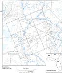
Typical Drainage Topography in the Suwannee River Area, 1988
This map from the U. S. Geological Survey Professional Paper 1403-C shows a typical pattern of topography and drainage in the karstic springs of the Suwannee River area where the Floridan aquifer is unconfined or semiconfined. Topographic relief is g...

Suwannee River, 1998
A National Oceanic and Atmospheric Administration map of the entrance to the Suwannee River current to 1998. This Survey chart shows all soundings expressed in feet. Navigational aids such as lights, beacons, buoys, and magnetic variance and annual i...


  FL Maps > Local > Suwannee
Site Map  

Maps ETC is a part of the Educational Technology Clearinghouse
Produced by the Florida Center for Instructional Technology © 2007
College of Education , University of South Florida