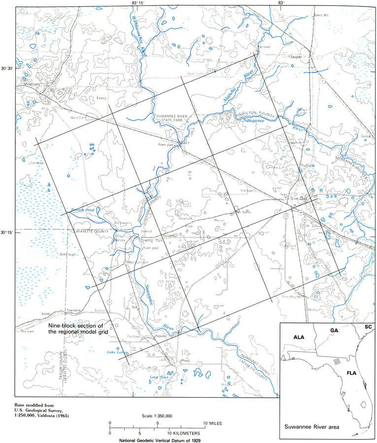
Description: This map from the U. S. Geological Survey Professional Paper 1403-C shows a typical pattern of topography and drainage in the karstic springs of the Suwannee River area where the Floridan aquifer is unconfined or semiconfined. Topographic relief is generally less and more subdued than in the northern areas of the Floridan aquifer system in Georgia, the surface drainage is virtually nonexistent, and drainage is internal until it reaches springs or the major streams that are well incised into the Upper Floridan limestone.
Place Names: Suwannee, counties, Suwannee, Live Oak, Suwannee River State Park
ISO Topic Categories: boundaries, geoscientificInformation, inlandWaters, elevation
Keywords: Typical Drainage Topography in the Suwannee River Area, physical, political, hydrological, khydrological, kFloridan aquifer, ktopography, physical features, topographical, major political subdivisions, county borders, water table, boundaries, geoscientificInformation, inlandWaters, elevation, Unknown,1988
Source: P. W. Bush and R. H. Johnston, USGS Professional Paper 1403-C (Washington, DC: U. S. Government Printing Office, 1988) C42
Map Credit: Courtesy the University of South Florida Library |
|