Maps Site map
  FL Maps > County > Holmes
Site Map  

Holmes County Maps

Click on a thumbnail image to view a full size version of that map.

Holmes County is Florida's 27th county, established on January 8, 1848, from segments of Walton County and Jackson County. It gains its name from Holmes Creek, which serves as the eastern boundary of the county. Bonifay is the county seat.

For earlier maps of this area, visit the Walton County and Jackson County map galleries.
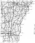
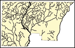
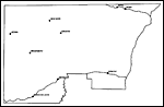

  Record   51   to   68  of   68

East Holmes, 1936
This is a detailed map of the east portion of the county of Holmes in the state of Florida. Section Township Range (STR) is shown. This map shows all of the main cities, state roads, US Highways, bridge highways, federal aided highway, saw mills, rai...

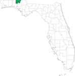
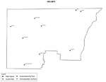
Locater Map of Holmes County, 2008
This is a locater map for Holmes County, 2008. The state is transparent while the county itself is highlighted by color. ...

Clipart Collection: Holmes County Maps in 50 Colors, 2008
A collection of simplified outline maps of Holmes County in your choice of four sizes and fifty colors. These maps are in the GIF format and have very small file sizes so they will download quickly. Use them on your Web pages or in presentations. All...

Plain Frames Collection: Holmes County Maps in 30 Colors, 2008
A collection of transparent frame maps of Holmes County in your choice of thirty colors. Combine these frames with your own photo to create a photo in the shape of the county. Use them on your Web pages or in presentations. ...

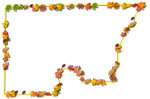
Fancy Frames Collection: Holmes County Maps in 30 styles, 2008
A collection of transparent frame maps of Holmes County in your choice of thirty styles including leaves, flowers, shells, hearts, stars, stone, and wood. Combine these frames with your own photo to create a photo in the shape of the map. Use them ...

Florida Photo Collection: Holmes County Maps in 30 styles, 2008
A collection of photo maps of Holmes County in your choice of thirty styles including birds, flowers, sunset, dolphins, leaves, hurricane, palms, and water. Use them on your Web pages or in presentations. ...

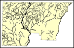
Florida Waterways: Holmes County Outline, 2008
This map was created by FCIT and shows the waterways of Holmes County. All major rivers, streams, creeks, lakes, and swamps are labeled. This map features Corbett Branch, Holmes Creek, Wrights Creek, Texas Branch, Tenmile Creek, Titi Branch, Limeston...

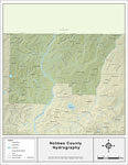
Florida Waterways: Holmes County , 2008
This map was created by FCIT and shows the waterways of Holmes County. All major rivers, streams, creeks, lakes, and swamps are labeled. This map features Corbett Branch, Holmes Creek, Wrights Creek, Texas Branch, Tenmile Creek, Titi Branch, Limeston...

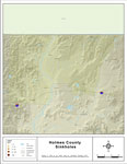
Sinkholes of Holmes County, Florida , 2008
This map was created by FCIT and represents reported sinkhole events in Holmes County based on data gathered by the Florida Geological Survey (FGS) and the Florida Department of Environmental Protection (FDEP). " This dataset represents a set of...

Florida Waterways: Holmes County Outline without Labels, 2008
This topographical map was created by FCIT and shows the waterways of Holmes County. All major rivers, streams, creeks, canals, bays and lakes are present, but not labeled. For a student activity sheet with directions for labeling the following: Choc...

Holmes "Abstract" Style Maps in 30 Styles, 2008
A collection of 30 Holmes County maps in a range of abstract graphic styles suitable for use in presentations and websites. Since the style is abstract, these maps can be used in projects on a wide variety of topics. Each of the maps is in the JPEG f...

Holmes County "Fun" Maps in 30 Styles, 2008
A collection of 30 Holmes County maps in a crazy range of styles including blue jeans, chalkboards, pirate maps, coins, hearts, and even swimming pools. Use them as attention-getting slides in presentations or on websites. Each of the maps is in the...

Holmes County Cities with Labels, 2009
This is a black and white city map of Holmes county, 2009. It shows the location with names of unincorporated cities/towns (black dot) such as Izagora, incorporated cities/towns (circle with dot) such as Westville, and the county seat (circle with st...

Holmes County Cities Outline, 2009
This is a black and white city outline map of Holmes county, 2009. It shows the location without names of unincorporated cities/towns (black dot), incorporated cities/towns (circle with dot), and the county seat (circle with star)....

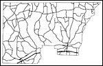
Holmes County Road Network- Black and White, 2009
This is a black and white road map of Holmes county, 2009. It shows the location of many roads, including SR-2, US-90 and I-10. ...

Holmes County Railway Network- Black and White, 2009
This is a black and white railroad map of Holmes county, 2009. It also shows location of cities and towns including Noma and Bonifay....

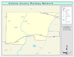
Holmes County Railway Network- Color, 2009
This is a color railroad map of Holmes county, 2009. It also shows location of cities and towns including Noma and Bonifay, inland water including rivers and lakes, and Amtrak stations....

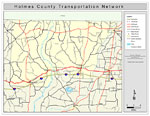
Holmes County Road Network- Color, 2009
This is a color road map of Holmes county, 2009. It shows the location of many roads including US-90 and I-10, cities and towns, and inland water....

First Previous


  FL Maps > County > Holmes
Site Map  

Maps ETC is a part of the Educational Technology Clearinghouse
Produced by the Florida Center for Instructional Technology © 2007
College of Education , University of South Florida