|
|
|
| FL Maps > Region > 1900-1919 |
|
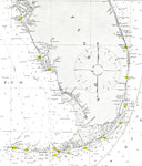
Straits of Florida and Approaches,
1908 |
|
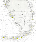
Straits of Florida,
1908 |
|
Hillsboro River, Florida,
1910 |
|
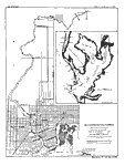
Florida, Everglades Drainage,
1918 |
| FL Maps > Region > 1900-1919 |
Maps ETC
is a part of the
Educational Technology Clearinghouse
Produced by the
Florida Center for Instructional Technology
© 2007
College of Education
,
University of South Florida