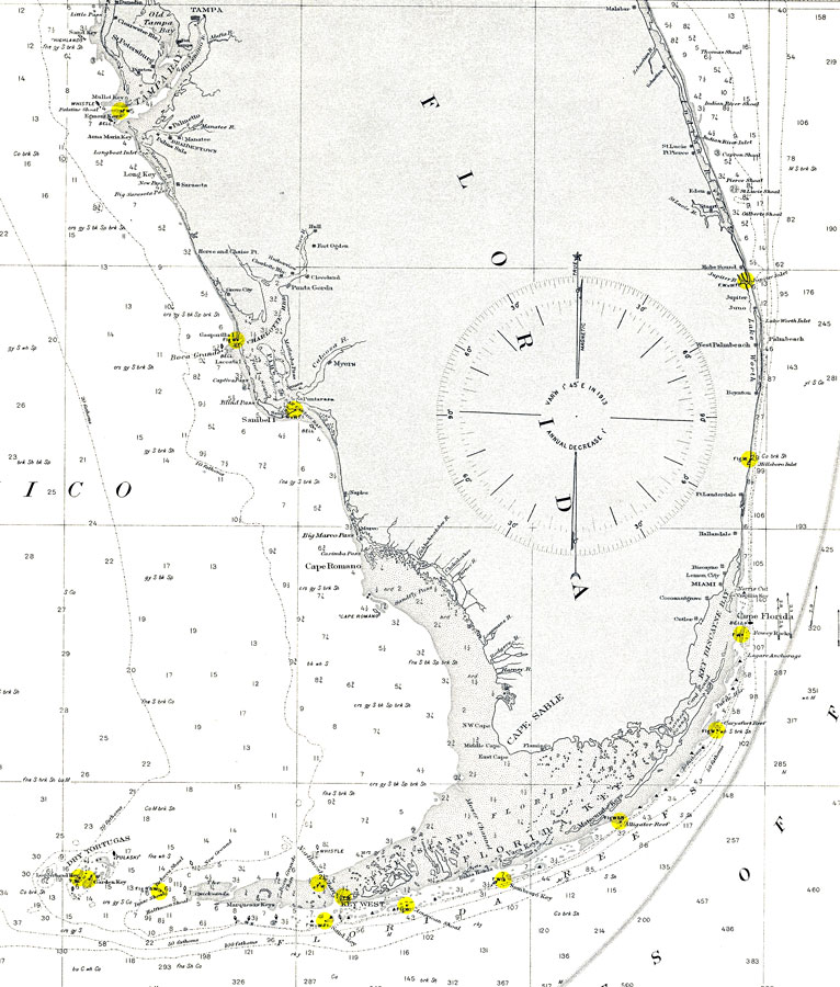
Description: A United States Department of Commerce and Labor map of the Straits of Florida current to 1908. This Coast and Geodetic Survey chart shows all soundings expressed in fathoms and heights in feet. Navigational aids such as the direction and velocity of the Gulf Stream, lights, beacons, and measures of magnetic declination variances are shown. Key to NOAA maps.
Place Names: 1900-1919, Key West, Cuba, Habana, Bahama Islands, Fort Lauderdale, Myers, West Palm Beach, Sarasota, St Petersburg, Tampa
ISO Topic Categories: boundaries, elevation, oceans, transportation
Keywords: Straits of Florida and Approaches, physical, political, transportation, hydrological, physical features, topographical, country borders, water routes, water depths, boundaries, elevation, oceans, transportation, Mercator, 1908
Source: National Oceanic and Atmospheric Administration, Atlantic Coast (Washington, DC: United States Coast and Geodetic Survey, 1908)
Map Credit: Courtesy the U.S. National Oceanic and Atmospheric Administration |
|