Home > Maps > Hurricanes > Hurricane Charley > August 10, 9:45 a.m.
Site Map | Search


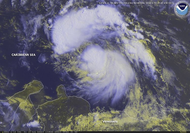
August 10, 9:45 a.m.


Tropical Storm Charley located in the Caribbean Sea, At 11:00 a.m. EDT, the National Hurricane Center indicated that Charley was located 350 miles (560 km) to the south-southeast of Santo Domingo, Dominican Republic with sustained winds of 45 mph. ZOOM
Map Credit: Courtesy National Oceanic & Atmospheric Administration (NOAA).

[back] [next map]


Home > Maps > Hurricanes > Hurricane Charley > August 10, 9:45 a.m.
Site Map | Search


Exploring Florida: A Social Studies Resource for Students and Teachers
Produced by the Florida Center for Instructional Technology,
College of Education, University of South Florida ©2004.