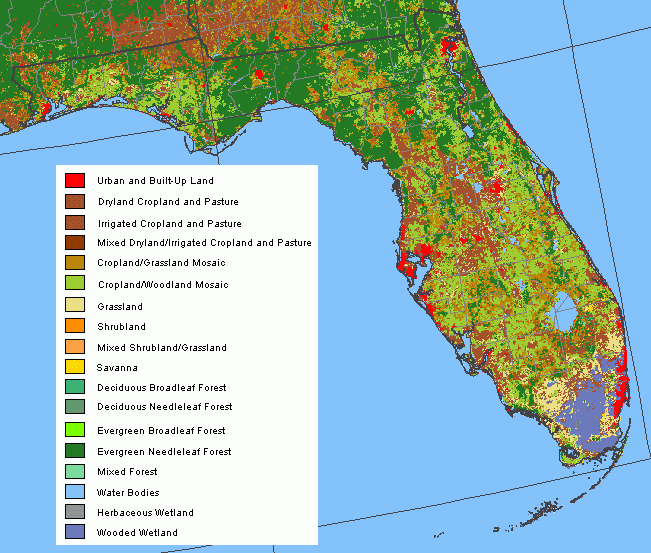
| Home > Maps > Land Use > Land Cover Characteristics | |
Map Credit: Courtesy of the National Atlas.
![[next map]](../../i/next.gif)
| Home > Maps > Land Use > Land Cover Characteristics |
Exploring
Florida: A Social Studies Resource for Students and Teachers
Produced by the Florida Center for Instructional
Technology,
College of Education, University of South Florida © 2004.