| Home > Maps > Duval City and Local > Fort Clinch, 1863 | |
|
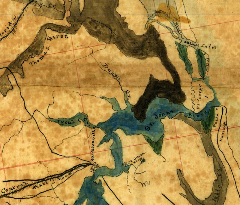
Detailed view of Jacksonville from a map of the coast between Savannah
and St. Augustine that shows swamps, marshes, and railroads and was drawn
around 1863.
|
|
Map Credit: Courtesy of the Library of Congress, Geography and Map Division.
|
| Home > Maps > Duval City and Local > Fort Clinch, 1863 |
Exploring
Florida: A Social Studies Resource for Students and Teachers
Produced by the Florida Center for Instructional
Technology,
College of Education, University of South Florida © 2002.